
| Area | South Fork Big River |
| Topic | Sediment: Matthews Road Locations & Surfaces Daugherty Cr Basin 2000 |
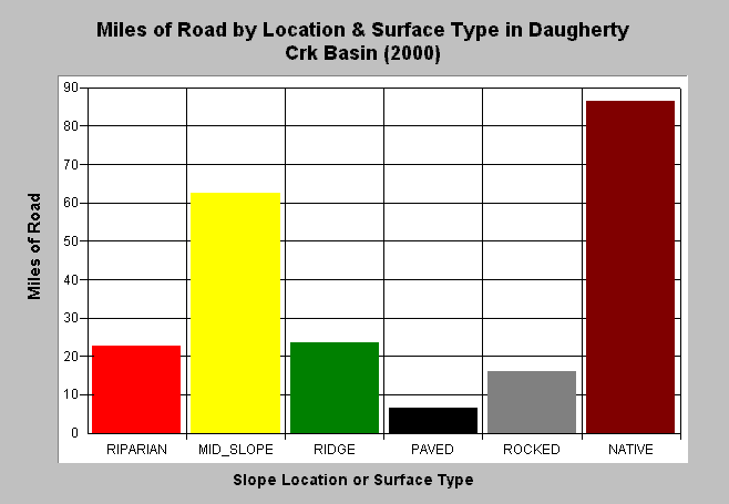
| Caption: The chart above shows the existing miles of road by location and surface type in the Daugherty Creek basin as of year 2000. The majority of roads are located mid-slope and are of native surface (i.e. unpaved). Data is from Matthews and Associates (2001). See Info Links for more background information and links to references. | |
 |
To learn more about this topic click here .
To view the table with the chart's data, click Chart Table web page.
To download the table with the chart's data, click roads_type_location_dc.dbf (size 224 bytes) .
To see meta information about the data table used for this topic click here
To view the table with the chart's source data, click Source Table web page.
To download the table with the chart's source data, click roads_type_location_allsubs.dbf (size 2,194 bytes)
| www.krisweb.com |