
| Area | South Fork Big River |
| Topic | Timber Harvest: Matthews Harvested Acres, South Fork Basin 1921-2000 |
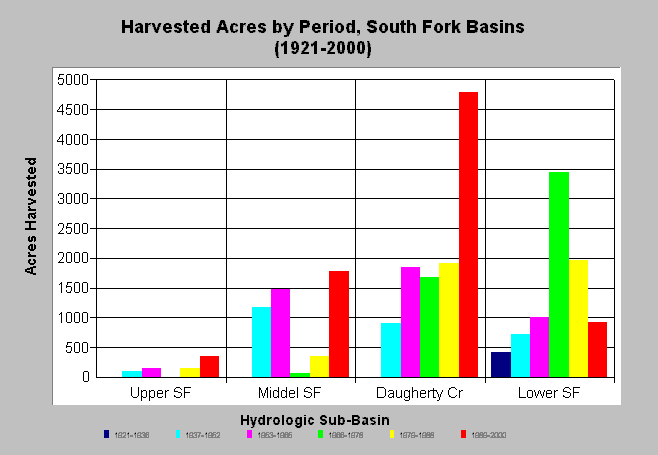
| Caption: The chart above shows total harvested acres by period in South Fork Big River sub-basins from 1921 to 2000. Harvested area in Daugherty Creek in the 1989-2000 period was twice as large as in previous periods, although the earliest cycle of logging in the late 1800's was not distinguishable from aerial photos. See Info Links for more background information and links to references. | |
 |
To learn more about this topic click here .
To view the table with the chart's data, click Chart Table web page.
To download the table with the chart's data, click harvest_matthews_sf.dbf (size 1,506 bytes) .
To see meta information about the data table used for this topic click here
To view the table with the chart's source data, click Source Table web page.
To download the table with the chart's source data, click harvest_matthews.dbf (size 3,786 bytes)
| www.krisweb.com |