
| Area | Upper Big River |
| Topic | Sediment: Matthews Road Construction by Period Upper Basin 1921-2000 |
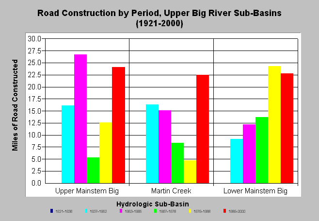
| Caption: The chart above shows the miles of road construction by period for each Upper Big River sub-basin. Road construction continues to be active in all sub-basins. Matthews and Associates (2001) state: "Significant construction of new roads has led to increasing sediment yields from road surface erosion, despite improved practices." Mileage estimates were generated largely from CDF data and aerial photography analysis Matthews Associates (2001). The time periods shown above are the years of the aerial photos used and cover the period back to the previous photo year. See Info Links for more background information and links to references. | |
 |
To learn more about this topic click here .
To view the table with the chart's data, click Chart Table web page.
To download the table with the chart's data, click roads_const_period_ub.dbf (size 796 bytes) .
To see meta information about the data table used for this topic click here
To view the table with the chart's source data, click Source Table web page.
To download the table with the chart's source data, click roads_construct_period_allsubs.dbf (size 2,194 bytes)
| www.krisweb.com |