
| Area | Upper Big River |
| Topic | Timber Harvest: Matthews Harvested Acres, Headwaters Basins 1921-2000 |
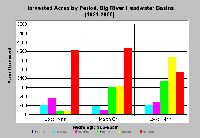
| Caption: The chart above shows total harvested acres by period in Big River Headwaters sub-basins between 1921 to 2000. It is likely these areas were also logged before 1900 but recognition of these areas was not distinguishable from aerial photos. Harvest activity has increased in the Upper Mainstem and Martin Creek basins in the most recent period (1989-2000). See Info Links for more background information and links to references. | |
 |
To learn more about this topic click here .
To view the table with the chart's data, click Chart Table web page.
To download the table with the chart's data, click harvest_matthews_headwaters.dbf (size 1,339 bytes) .
To see meta information about the data table used for this topic click here
To view the table with the chart's source data, click Source Table web page.
To download the table with the chart's source data, click harvest_matthews.dbf (size 3,786 bytes)
| www.krisweb.com |