
| Area | Upper Big River |
| Topic | Sediment: Matthews Erosion Channel Banks (vol/yr) for Upper Big |
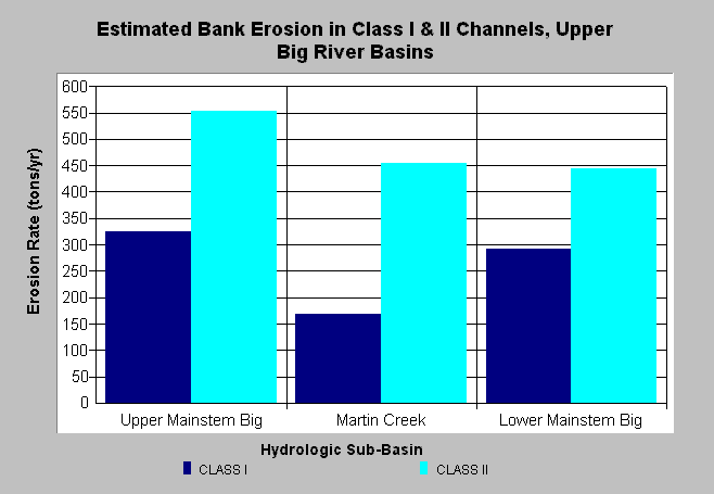
| Caption: The chart above shows fluvial erosion rate estimates for Class 1 and Class 2 streams in the Upper Big River watershed as determined by Matthews and Associates (2001). The classes refer to the California Department of Forestry convention where perennial fish bearing streams are Class 1, perennial non-fish bearing streams are Class 2 and intermittent streams are Class 3. Class 2 streams are afforded less protection from timber harvest than Class 1 streams are and they also yielded more erosion according to Matthews et al. (2001). See Info Links for more background information and links to references. | |
 |
To learn more about this topic click here .
To view the table with the chart's data, click Chart Table web page.
To download the table with the chart's data, click sediment_channel_erosion_ub.dbf (size 718 bytes) .
To see meta information about the data table used for this topic click here
To view the table with the chart's source data, click Source Table web page.
To download the table with the chart's source data, click sediment_channel_erosion.dbf (size 2,000 bytes)
| www.krisweb.com |