
| Area | Upper Big River |
| Topic | Sediment: Matthews Landslides Delivered, Upper Big 1921-2000 |
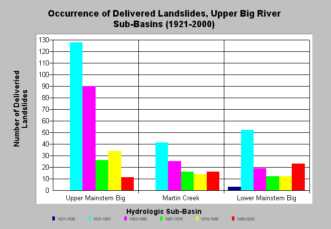
| Caption: The chart above shows the occurrence of delivered landslides during the study period for each Upper Big River sub-basin; derived from Matthews and Associates (2001). Estimates are generated from aerial photographs. The greatest sediment delivery appears to have occurred during the 1937-1952 and 1953-1965 periods. All sub-basins show current activity. The actual number of slides in the 1921-1936 period is likely an underestimate, since 1936 photo coverage for the eastern half of the watershed was unavailable. See Info Links for more background information and links to references. | |
 |
To learn more about this topic click here .
To view the table with the chart's data, click Chart Table web page.
To download the table with the chart's data, click slides_period_ub.dbf (size 934 bytes) .
To see meta information about the data table used for this topic click here
To view the table with the chart's source data, click Source Table web page.
To download the table with the chart's source data, click slides_period_allsubs.dbf (size 3,324 bytes)
| www.krisweb.com |