
| Area | Upper Big River |
| Topic | Sediment: Matthews Landslides Volumes by Land-Use Upper Big 1921-2000 |
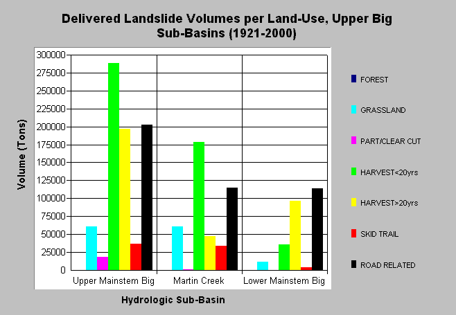
| Caption: The chart above shows the total estimated sediment volumes from delivered landslides by land-use practice for each Upper Big River sub-basin (1921-2000). Sediment volumes were computed by Matthews and Associates (2001). Under current conditions (1989-1999 period), management-related sediment delivery is estimated to be 51.7% of the total input (Matthews and Associates 2001). See Info Links for more background information and links to references. | |
 |
To learn more about this topic click here .
To view the table with the chart's data, click Chart Table web page.
To download the table with the chart's data, click slides_voltons_landuse_ub.dbf (size 865 bytes) .
To see meta information about the data table used for this topic click here
To view the table with the chart's source data, click Source Table web page.
To download the table with the chart's source data, click slides_vol_tons_landuse.dbf (size 2,712 bytes)
| www.krisweb.com |