
| Area | North Fork Garcia |
| Topic | Habitat: Percent Canopy Type for NF Garcia 1991 |
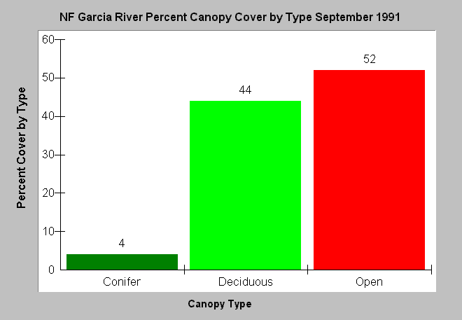
| Caption: The chart above shows canopy over the North Fork Garcia River from results of a September 1991 habitat typing survey. Canopy is measured with a densiometer from the center of the stream. Data indicate 52% of habitats surveyed along the North Fork Garcia lacked shade, 44% were shaded by deciduous trees, and only 4% by conifers. This also indicates a lack of available coniferous large woody debris for recruitment to the stream. Data were collected for the Garcia River Watershed Enhancement Plan (Mendocino County RCD, 1992). See InfoLinks for more information. | |
 |
To learn more about this topic click Info Links .
To view additional information (data source, aquisition date etc.) about this page, click Metadata .
To view the table with the chart's data, click Chart Table web page.
To download the table with the chart's data, click hab_can_gar_all.dbf (size 521 bytes) .
| www.krisweb.com |