 |
 |
| Background | Hypotheses | Bibliography | Maps | Home |
|
|
| Background | Hypotheses | Bibliography | Maps | Home |
KRIS Gualala Map: Fish and
Aquatic Habitat View
![]()
This KRIS Gualala Map project view is comprised of themes such as aquatic monitoring locations, habitat typing, hydrology and stream gradient. The California Department of Fish and Game provided 2001 habitat typing data, which is the basis of several map themes. The North Coast Regional Water Quality Control Board provided maps of Gualala Redwoods, Inc. monitoring locations for sediment, temperature and aquatic invertebrate monitoring. Knopp's (1993) sediment sampling locations are also found as a theme in this View. The U.S. Geologic Survey topographic map are used as a reference theme in this project.
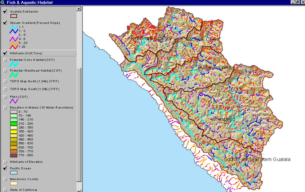 |
The image at left shows stream gradient based on 10 meter Digital Elevation Model (DEM) data. The large extent of stream reaches with gradient less than two percent (light and dark blue) shows why the Gualala was once a substantial producer of coho salmon. Mild gradients such as these were optimal for this species for both spawning and rearing. The reaches colored red are the steepest tributary areas, which tend to occur at headwaters in the eastern portion of the basin and in the North Fork. Ten meter DEM provided by the California Department of Forestry FRAP program. |
|
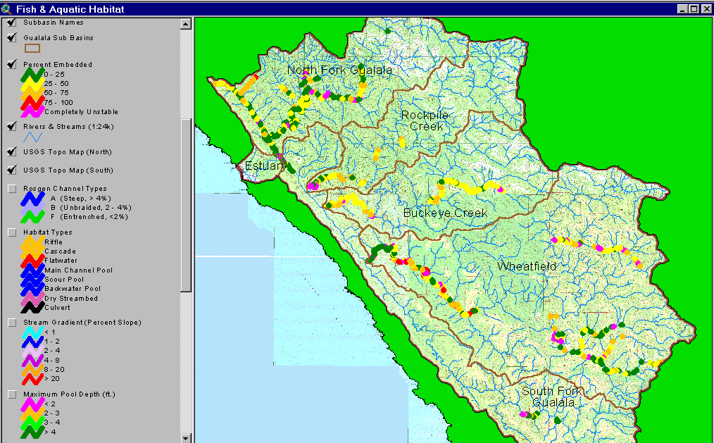
Embeddedness results of the CDFG 2001 Gualala habitat typing surveys are displayed at left with green symbols indicate the best salmonid spawning habitat (<25% embedded). The North Fork Gualala, lower Wheatfield, House Creek and South Fork reaches show the best scores while Tombs Creek, Buckeye Creek and the middle Wheatfield show impaired values. See Habitat Typing Information in KRIS Gualala for more information. |
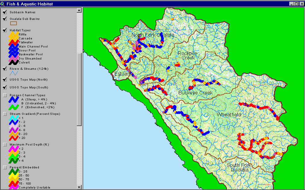 |
Pool frequency results of the CDFG 2001 Gualala habitat typing surveys show the pools in blue (at left). The North Fork Gualala, Wheatfield, and upper Buckeye Creek reaches show the highest occurrence of pools while Tombs Creek, House Creek and lower Buckeye Creek are dominated by flat water and riffles. |
![]()
References
CA Department of Fish and Game. 1998. California Salmonid Stream Habitat Restoration Manual. Third Edition. Inland Fisheries Division. California Department of Fish and Game. Sacramento, CA. 495 p.
Knopp, C. 1993. Testing Indices of Cold Water Fish Habitat. Final Report for Development of Techniques for Measuring Beneficial Use Protection and Inclusion into the North Coast Region's Basin Plan by Amendment of the.....Activities, September 18, 1990. North Coast Regional Water Quality Control Board in cooperation with California Department of Forestry. 57 pp.
![]()
| www.krisweb.com |