 |
 |
| Background | Hypotheses | Bibliography | Maps | Home |
|
|
| Background | Hypotheses | Bibliography | Maps | Home |
![]()
The California Department of Forestry in Santa Rosa provided the timber harvest plan (THP) maps from 1991 to 2001 for the Gualala River basin. These comprise this KRIS Gualala Map View. Timber harvests for these years can be viewed either by year or by timber harvest type. Timber harvest may sometimes disturbs soils, increases road densities and otherwise increases erosion risk. Increased sediment yield in turn may effect fish habitat and water quality. Because timber harvest is a widespread activity in northern California watersheds, it is an important factor to consider in watershed assessment. Note that timber harvest was active in some parts of the Gualala River basin between 1985 and 1990 and that these permitted harvests may also have taken place several years after approval. Therefore, the 1991-2001 plans do not fully reflect cumulative effects from timber harvest (see Cumulative Watershed Effects).
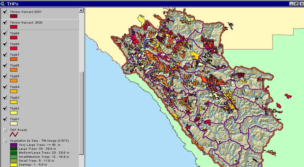 |
This image, from the KRIS Gualala Map project, shows timber harvests as mapped by the California Department of Forestry by year from 1991-2001. In the last 10 years, timber harvest has been most intensive in the northwest portions of the basin. Timber harvest between 1985-1990 was also active in some areas of the Gualala basin and while not shown on these maps, may still be a factor in sediment delivery. |
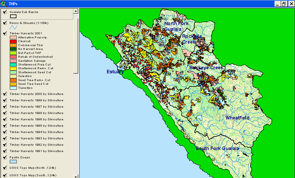 |
Timber harvests in the KRIS Gualala project area by silvicultural prescription are displayed at left. Clear cuts appear to be more prevalent in the western part of the basin and in the Buckeye subbasin in the Flat Ridge Creek Calwater. Although areas in the eastern part of the watershed do not show clear cuts, multiple entry logging may create landscapes that are clear cut equivalents. Note that polygons in the latter areas often overlap, showing multiple logging plans for the same area. |
![]()
| www.krisweb.com |