| Area |
Buckeye Creek |
| Topic |
Buckeye Creek Basin Location Maps |
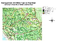
 Click on image to enlarge (152K). Click here to display a larger version (144K).
The image above is from the KRIS Gualala Map project and shows the elevation and relief of the Buckeye Creek watershed. The profile of the Buckeye watershed with regard to elevation is very similar to the Rockpile drainage with mild terrain in the west and the Coast Range rising in the east (Flat Ridge and NF Osser Creek Calwaters).
 Click on image to enlarge (84K). Click here to display a larger version (265K).
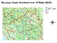
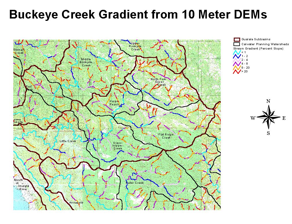
The image above from the KRIS Gualala Map project shows stream gradient for the Buckeye Creek basin. The mainstem of Buckeye Creek is less than 2% gradient and, therefore, optimal for coho salmon and steelhead spawning and rearing all the way up into the Flat Ridge Creek Calwater. The North Fork Buckeye also would have been accessible to coho through Harpo Reach and well up into the NF Osser Creek Calwater. Central Belt Franciscan Formation areas in the eastern portion Buckeye Creek have grasslands visible as white on the USGS Topo. Note that streams from these areas have extensive steep reaches. Headwaters are also steep (>20%) throughout the watershed. Gradient based on 10-meter data provided by California Dept. Forestry FRAP.
 Click on image to enlarge (106K).
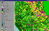
The image above is from the KRIS Gualala Map project and shows vegetation for the Buckeye Creek sub basin as interpreted from a 1994 Landsat image by the U.S. Forest Service Remote Sensing Lab. The vegetation pattern in the Buckeye Creek watershed is very similar to that of Rockpile Creek. Extensive patches of Non-Forest and Saplings (trees <5") in upper Buckeye Creek (North Fork Osser Creek and Flatridge Creek Calwaters) is in response to Central Belt Franciscan formation but similar patches in the west of the basin may be associated with recent clear cuts. Medium/Large Trees (20-29.9" diameter) and Small-Medium Trees (12-19.9" diameter) in the western portion of the basin are associated with highly productive forest soils.
 Click on image to enlarge (111K). Click here to display a larger version (315K).
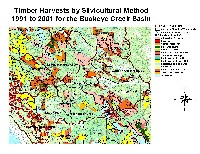
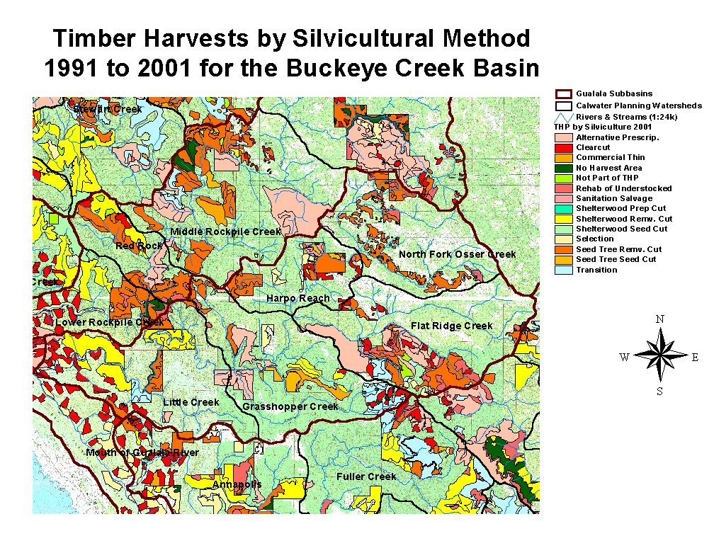
This map shows timber harvests between 1990 and 2001 as mapped by the California Department of Forestry. Timber harvest has been most intense in the lower portions of Little Creek CW, the center of Grasshopper Creek CW and in western Flat Ridge CW. Image copied from the KRIS Gualala Map project.
 Click on image to enlarge (204K).
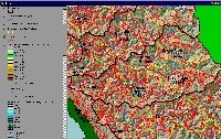
This image shows the roads in the Buckeye Creek basin as mapped by UC Davis ICE from 2000 aerial photo graphs. The highest road densities tend to be in the western basins where there are extensive timber haul road systems. Image from the KRIS Gualala Map Project.
 Click on image to enlarge (89K). Click here to display a larger version (271K).
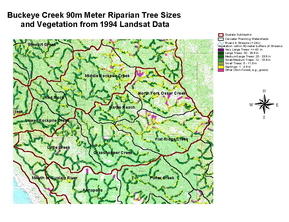
The image above shows USFS vegetation stand types for the riparian zone of all Buckeye Creek Calwater planning watersheds based on a 1994 Landsat image. The stand types are only accurate at the one-hectare scale and the buffer width is 90 meters. Much of the riparian shows as Non-Forest, Saplings and Small Trees in eastern Calwaters (NF Osser, Flat Ridge) as a result of natural grasslands in the Central Belt Franciscan mélange terrain. Small diameter trees in the riparian zones further west in the watershed are at least in part owing to continuing timber harvest. See Info Links for more information. Taken from the KRIS Gualala Map project.
 Click on image to enlarge (143K). Click here to display a larger version (181K).
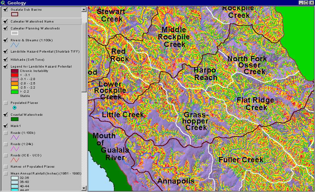
The map image above is of the shallow landslide stability model (SHALSTAB) generated from a ten-meter digital elevation model (DEMs) for the Buckeye Creek watershed with higher risk of shallow landslides coded in colors from yellow to red. Most of the basin, except for the east side of the Little Creek and Grasshopper Calwaters, are in moderate to high SHALSTAB risk areas. Parts of NF Osser Creek are in low-risk areas because earthflows do not maintain steep enough slopes to pose a risk of debris sliding. Inner gorge locations and headwater swales show a pattern of high risk throughout the Buckeye Creek basin. The SHALSTAB run was performed by Dr. Jan Derksen based on 10m DEM data provided by the California Department of Forestry FRAP division.
To learn more about this topic click Info Links

 Click on image to enlarge (152K). Click here to display a larger version (144K).
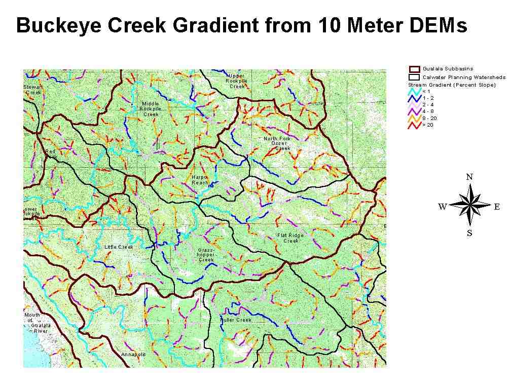 Click on image to enlarge (84K). Click here to display a larger version (265K).
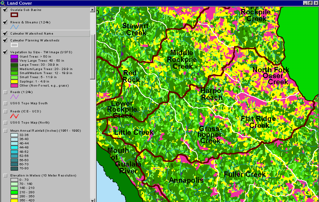 Click on image to enlarge (106K).
 Click on image to enlarge (111K). Click here to display a larger version (315K).
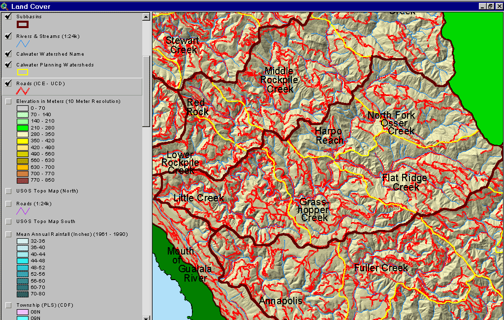 Click on image to enlarge (204K).
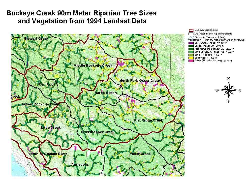 Click on image to enlarge (89K). Click here to display a larger version (271K).
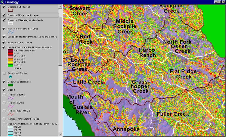 Click on image to enlarge (143K). Click here to display a larger version (181K).
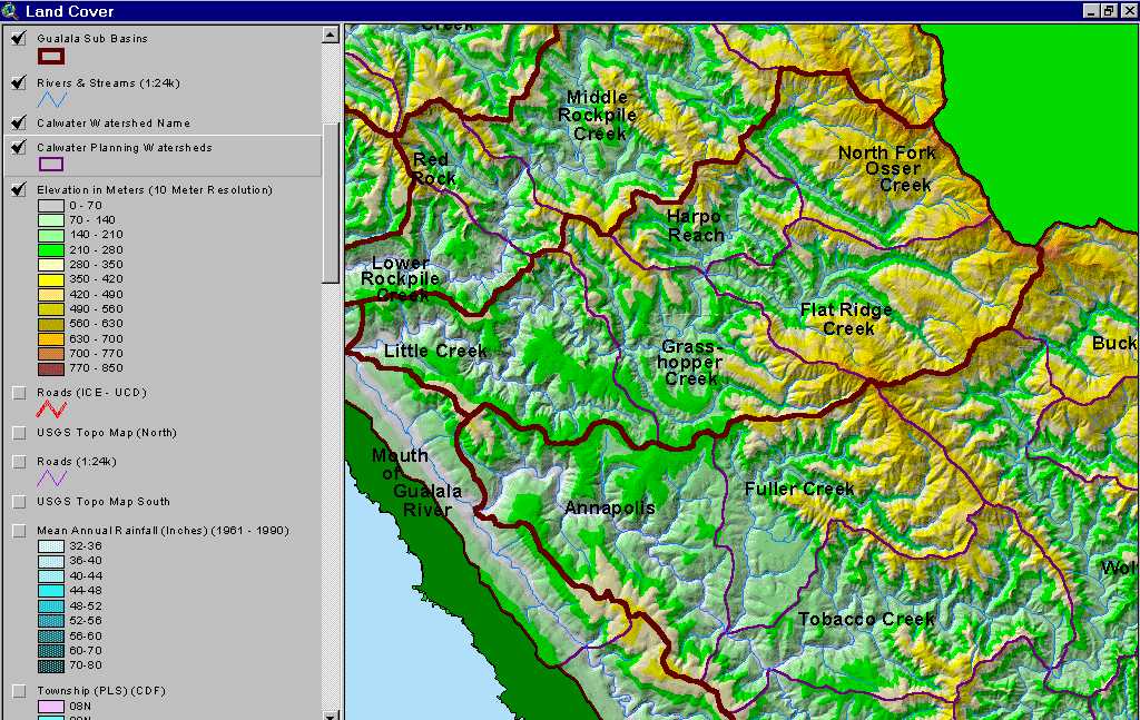