
| Area | Buckeye Creek |
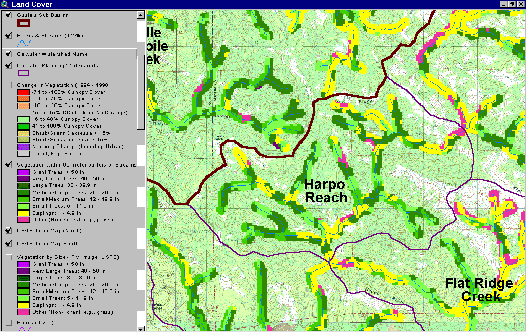
| Topic | USFS Riparian Tree Size Classes: Harpo Reach CalWater 1994 |
The image above shows USFS vegetation stand types for the riparian zone of the Billings Creek Calwater planning watershed based on a 1994 Landsat image. The stand types are only accurate at the one-hectare scale and the buffer width is 90 meters. Much of the riparian shows as Non-Forest, Saplings and Small Trees as a result of natural grasslands. Although some Saplings (<5" diameter) may be in part associated with grasslands, in combination with Small Trees (5-11" diameter), they may also represent some areas of recent timber harvest. See Info Links for more information. Taken from the KRIS Gualala Map project.
Very little of the riparian zone of the Harpo Reach Calwater showed timber harvest effects between 1994 and 1998 according to Landsat images as derived by the California Department of Forestry FRAP division. From the KRIS Gualala Map project
 Click on image to enlarge (178K).
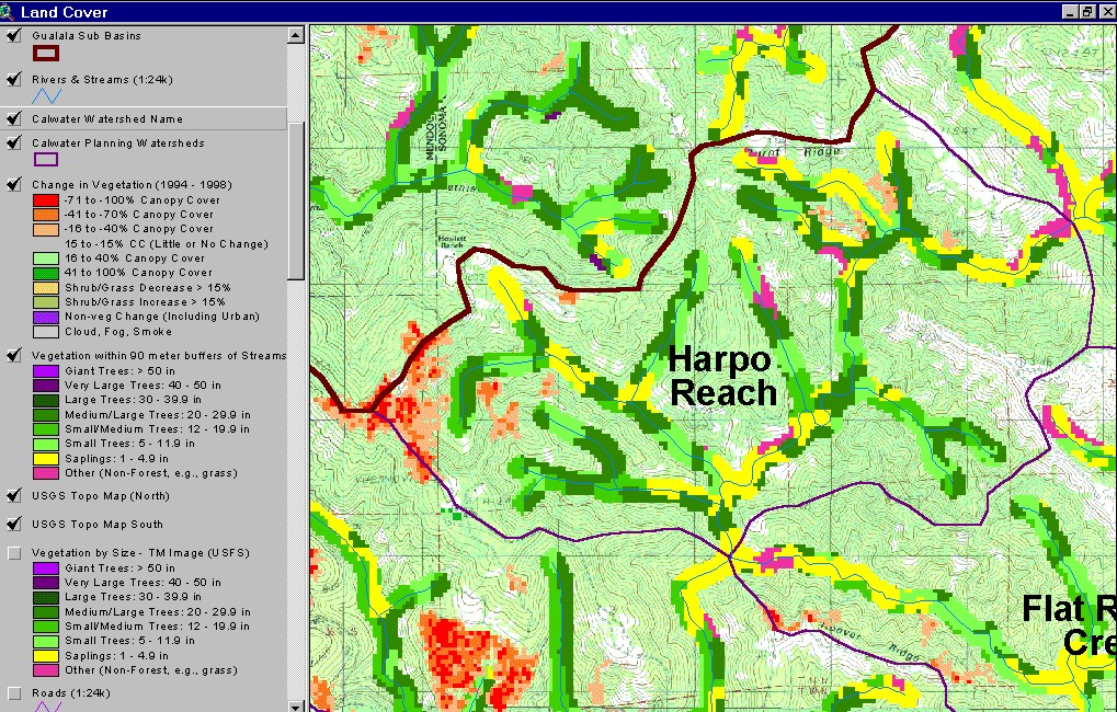 Click on image to enlarge (180K).
To learn more about this topic click Info Links
| www.krisweb.com |