| Area |
Buckeye Creek |
| Topic |
Habitat Typing: Pool Depth Frequency for Buckeye Creek |
 Click on image to enlarge (110K). Click here to display a larger version (171K).
The map above is derived from data provided by the California Department of Fish and Game and shows the maximum pool depth for all Buckeye Creek reaches surveyed. Pools are mostly less than three feet deep, which indicates that Buckeye Creek is limited by sediment with regard to its salmonid habitat carrying capacity. Image taken from the KRIS Gualala Map project.
To learn more about this topic click Info Links

 Click on image to enlarge (110K). Click here to display a larger version (171K).
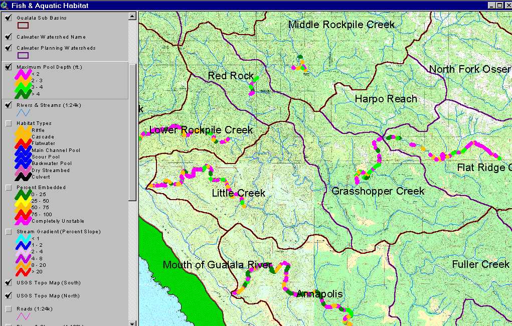