
| Area | Basin-wide/General |
| Topic | Habitat: Maximum Pool Depths (All) |
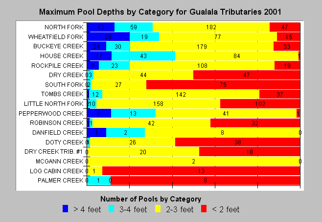
| Caption: California Department of Fish and Game surveys of the Gualala River in 2001 measured maximum depth for every pool surveyed. The chart above lists streams by stream order with larger streams near the top. Most pools in Gualala tributaries are less than three feet deep, and that this even applies to the largest streams (North Fork and Wheatfield). Smaller streams had a high occurrence of pools measuring less than two feet deep. See Info Links for more information. | |
 |
To learn more about this topic click Info Links .
To view a table of information about this data click Metadata .
To view the table with the chart's data, click Chart Table web page.
To download the table with the chart's data, click hab_mega_sum_12_25.dbf (size 11,401 bytes) .
To view the table with the chart's source data, click Source Table web page.
To download the table with the chart's source data, click gua_habdata.dbf (size 6,617,216 bytes)
| www.krisweb.com |