
| Area | Basin-wide/General |
| Topic | Gualala Basinwide Location Maps #2 |
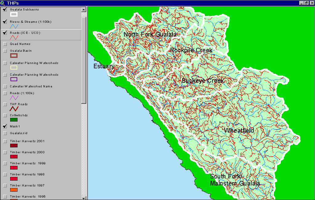
The image above comes from the KRIS Gualala Map project and shows roads and large sub basin NCWAP study areas. Road densities are low in the highly erodible earthflow terrain of the eastern and southeastern portions of the watershed. Road densities are highest in industrial timberland holdings in the western and northwestern portions of the Gualala basin. The road data were generated by the University of California Davis ICE project for the California Water Resources Control Board as part of the Gualala TMDL.
The image above comes from the KRIS Gualala Map project and shows timber harvests as mapped by the California Department of Forestry by year from 1991-2001. The timber harvests shown above are for the entire basin and have been approved but may not have been implemented.
The map image above is of slope steepness generated from a ten-meter digital elevation model (DEMs) with steeper slopes coded in colors from yellow to red. The steepest slopes in the Gualala River watershed are located in the North Fork, Rockpile, parts of Buckeye Creek and the eastern Wheatfield. Steep slopes occur in relatively few locations in the South Fork. The California Department of Forestry FRAP division provided the 10m DEM data.
The map image above is of the shallow landslide stability model (SHALSTAB) generated from a ten-meter digital elevation model (DEMs) with higher risk of shallow landslides coded in colors from yellow to red. The highest risk slopes are concentrated in the North Fork Gualala River watershed, although slopes are also susceptible to debris sliding in much of Rockpile, parts of Buckeye Creek and the central and eastern Wheatfield. Inner gorge locations also show high risk of debris slides such as area along the South Fork and lower Wheatfield. The SHALSTAB run was performed by Dr. Jan Derksen based on 10m DEM data provided by the California Department of Forestry FRAP division.
The map above shows water temperature results from a number of locations in the Gualala River basin with reference to their suitability for coho salmon (Welsh et al., 2001). Red dots show locations of temperature probes that exceeded a maximum floating weekly average temperature of 16.8 degrees Celsius (unsuitable for coho), green shows where that threshold was not exceeded (suitable for coho) and yellow indicates where 16.8 C MWAT was exceeded in some years but not in others. Data provided by Gualala Redwoods, Inc. (GRI) and the Gualala River Watershed Council (GRWC).
 Click on image to enlarge (68K).
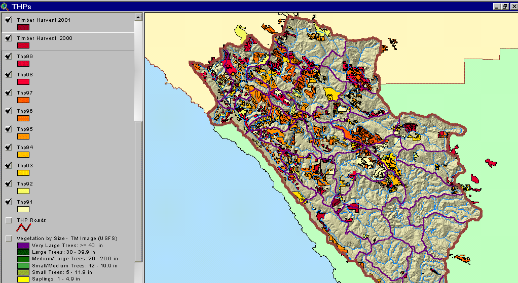 Click on image to enlarge (128K).
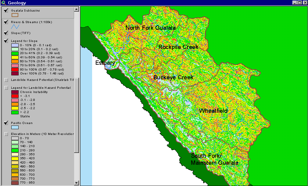 Click on image to enlarge (93K).
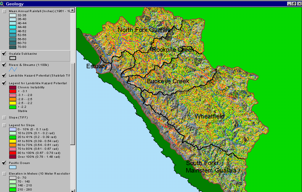 Click on image to enlarge (148K).
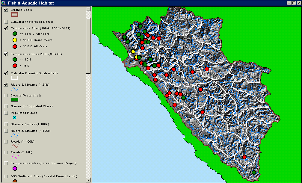 Click on image to enlarge (106K).
To learn more about this topic click Info Links
| www.krisweb.com |