| Area |
Basin-wide/General |
| Topic |
Tour: Gualala TMDL Pictures |
 Click on image to enlarge (39K).
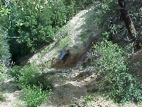
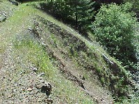
The image above shows a large slide associated with a road immediately adjacent to a major tributary of the Gualala River. This road location is high risk in that it is on steep slopes right above the watercourse in what is known as an "inner gorge" location. Photo by Brian McFadin, North Coast Regional Water Quality Control Board.
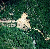
 Click on image to enlarge (124K). Click here to display a larger version (1,672K).
The aerial photo above shows a dense network of skid trails on fairly steep slopes. These are not calculated as part of road density and may persists as potential erosional features long after a timber harvest is completed. If skid trails are oriented down hill, they may concentrate water and create gully erosion. Photo by Brian McFadin, North Coast Regional Water Quality Control Board.
 Click on image to enlarge (122K).
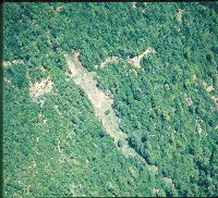
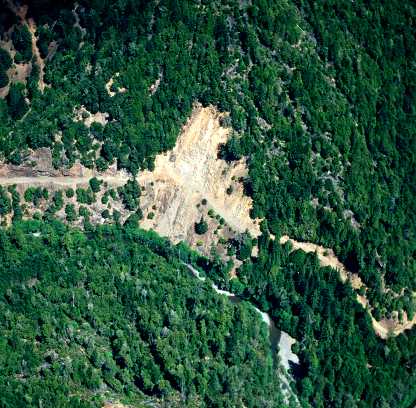
This picture shows a road washout somewhere in the Gualala basin and exemplifies the type of event that has contributed to over-supply of sediment in the watershed. Photo by Brian McFadin, North Coast Regional Water Quality Control Board.
 Click on image to enlarge (50K). Click here to display a larger version (247K).
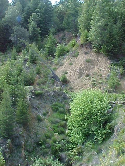
This landslide scar is partially healed with trees and shrubs starting to colonize the active surface. A road prism is evident just below the center of the picture and this slide was likely initiated by road failure. Photo by Brian McFadin, North Coast Regional Water Quality Control Board.
 Click on image to enlarge (44K). Click here to display a larger version (222K).
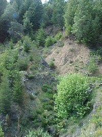
This picture shows the same slide as in Picture #2 from the side with the road prism running across the photo again just below the center. Photo by Brian McFadin, North Coast Regional Water Quality Control Board.
 Click on image to enlarge (96K). Click here to display a larger version (502K).
This picture typifies a cut and fill failure of a road which triggered a very large debris slide on a steep slope above a Gualala River tributary. The road does not appear to have been in active use at the time of this failure. Photo by Brian McFadin, North Coast Regional Water Quality Control Board.
 Click on image to enlarge (1,700K).
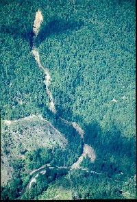
This photo shows the path of a debris torrent traveling from a mid-slope position directly to a Gualala River tributary. Photo by Brian McFadin, North Coast Regional Water Quality Control Board.
 Click on image to enlarge (125K).
This photo shows a road failure or landslide initiated by the road where fill was side cast onto the slope below the road. The change in gravity where the fill was deposited triggered the slide and is known as a fill failure. Photo by Brian McFadin, North Coast Regional Water Quality Control Board.
To learn more about this topic click Info Links

 Click on image to enlarge (39K).
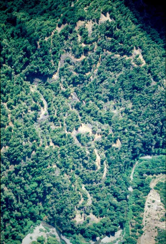 Click on image to enlarge (124K). Click here to display a larger version (1,672K).
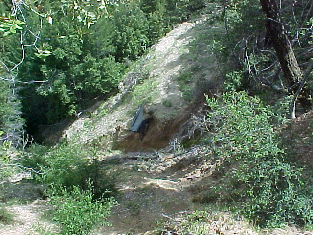 Click on image to enlarge (122K).
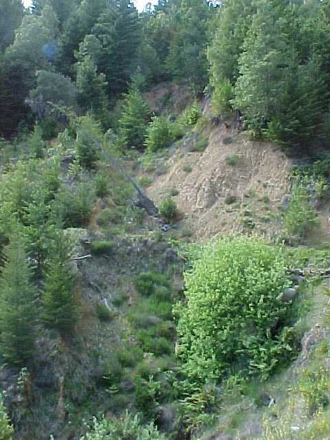 Click on image to enlarge (50K). Click here to display a larger version (247K).
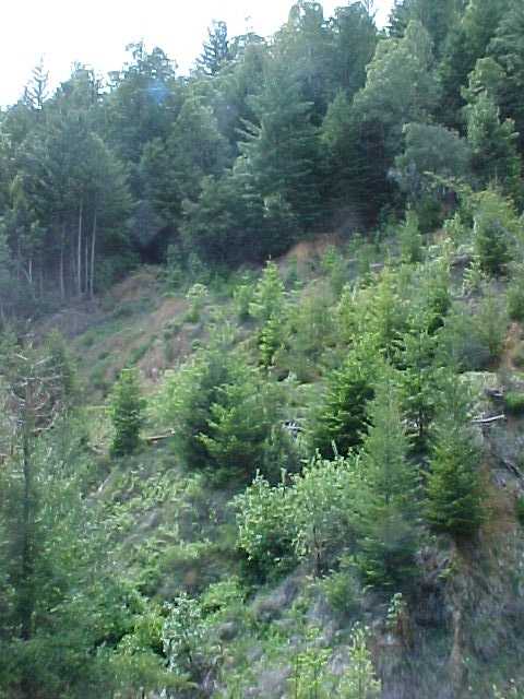 Click on image to enlarge (44K). Click here to display a larger version (222K).
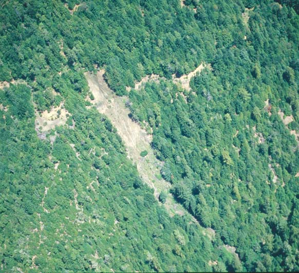 Click on image to enlarge (96K). Click here to display a larger version (502K).
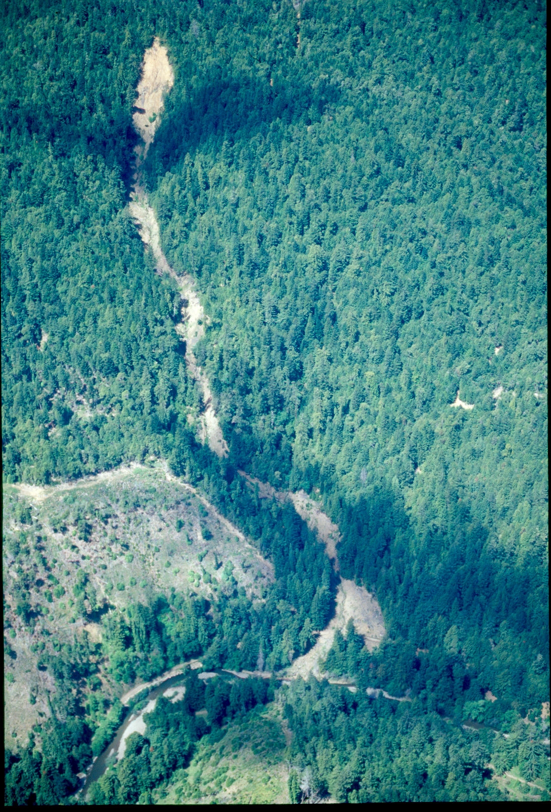 Click on image to enlarge (1,700K).
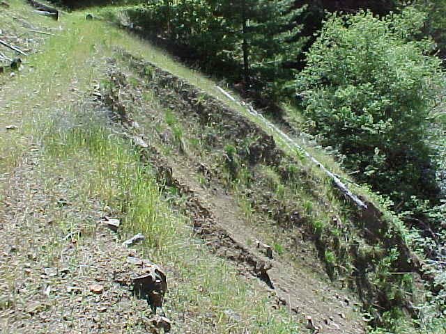 Click on image to enlarge (125K).