
| Area | Basin-wide/General |
| Topic | Habitat: Embeddedness at Pool Tails (All) |
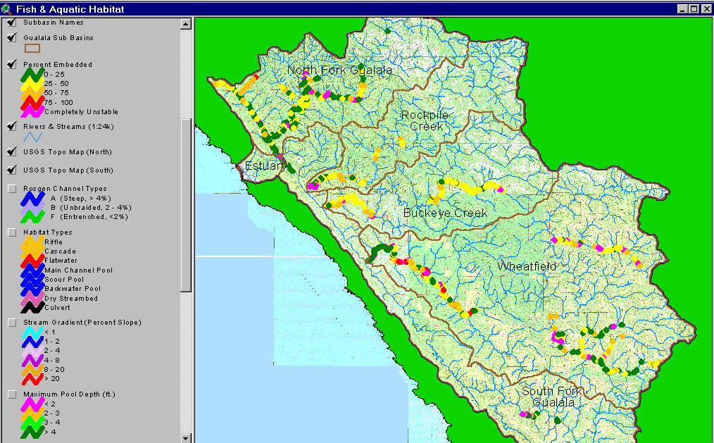
This image shows the embeddedness results of the CDFG 2001 Gualala habitat typing surveys. The green symbols indicate the best salmonid spawning habitat with the North Fork Gualala, lower Wheatfield, House Creek and South Fork reaches showing the highest occurrence. Tombs Creek, Buckeye Creek and the middle Wheatfield show impaired values. Spatial data provided by the California Department of Fish and Game. See Info Links for more information. Image taken from the KRIS Gualala Map project.
 Click on image to enlarge (144K).
To learn more about this topic click Info Links
| www.krisweb.com |