
| Area | North Fork |
| Topic | USFS Riparian Tree Size Classes: Doty Creek CalWater 1994 |
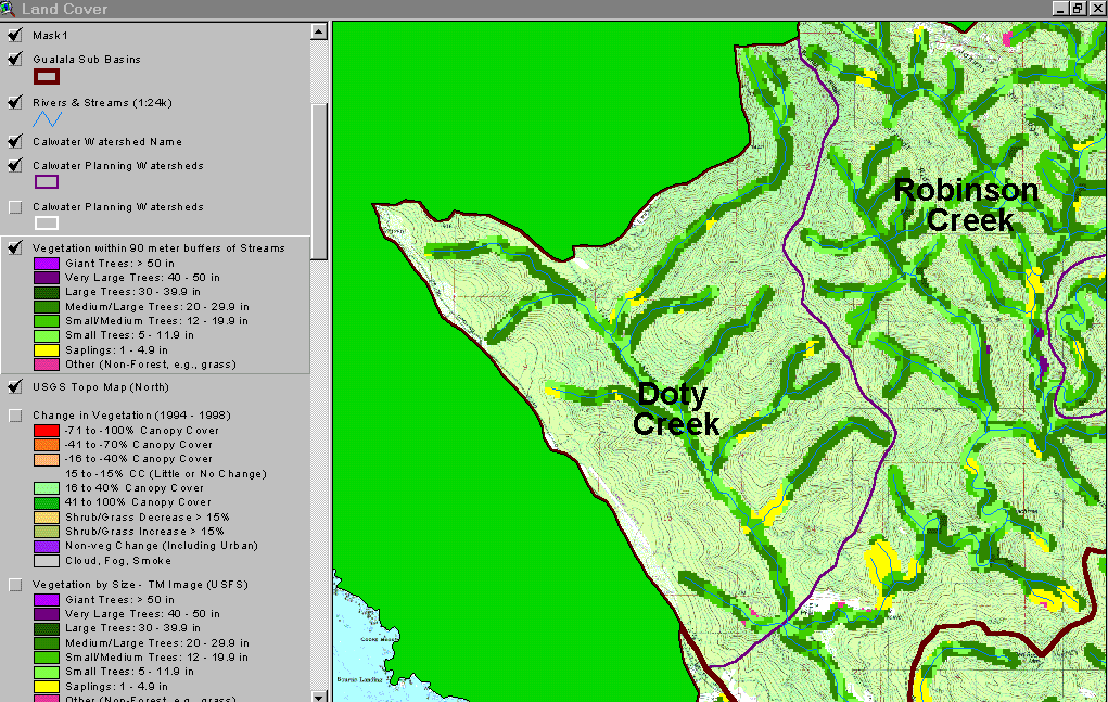
The image above shows USFS vegetation stand types for the riparian zone of the Little North Fork Gualala (Doty Cr Calwater) planning watersheds based on a 1994 Landsat image classified by the USFS Spatial Analysis Lab in Sacramento. The stand types are only accurate at the one-hectare scale and the buffer width is 90 meters on each side of the stream. Although the 1994 vegetation classification showed 55% of the riparian as Medium/Large Trees (20-29.9" diameter), more trees in this size class are on tributaries. The mainstem Little North Fork riparian has only disbursed patches of these larger trees. Most of the riparian is dominated by Small/Medium Trees (12-19.9" diameter) and Small Trees (5-11.9" diameter). This represents a major restoration challenge because it indicates that there is little chance for LWD recruitment naturally for at least fifty years. Some large wood in the 90-meter zone of the upper Little NF was also harvested between 1994 and 1998 (see Picture #2). See Info Links for more information. Taken from the KRIS Gualala Map project.
This image is the same as Picture #1, showing the Doty Creek Calwater with a 90 meter buffer riparian zone based on Landsat, but in this view the change in vegetation between 1994 and 1998 is also presented. The "change scene detection" is provided by CDF FRAP and is based on the same 1994 Landsat imagery as the USFS classification but also a 1998 Landsat. Red and orange indicate that the canopy cover has been reduced substantially. An intensive timber harvest within a 90-meter buffer is evident in the upper Little North Fork, which will reduce large wood recruitment to areas downstream in the event of a landslide or debris torrent. The small lineament on the change scene about two thirds of the way up Doty Creek coming in from the north may be the track of a debris torrent, not timber harvest. The latter is a common mechanism for large wood delivery to streams and the large wood entrained in the slides catches up in jams metering sediment delivery and buffer some reaches downstream from impacts. Map image copied from the KRIS Gualala Map project.
 Click on image to enlarge (139K).
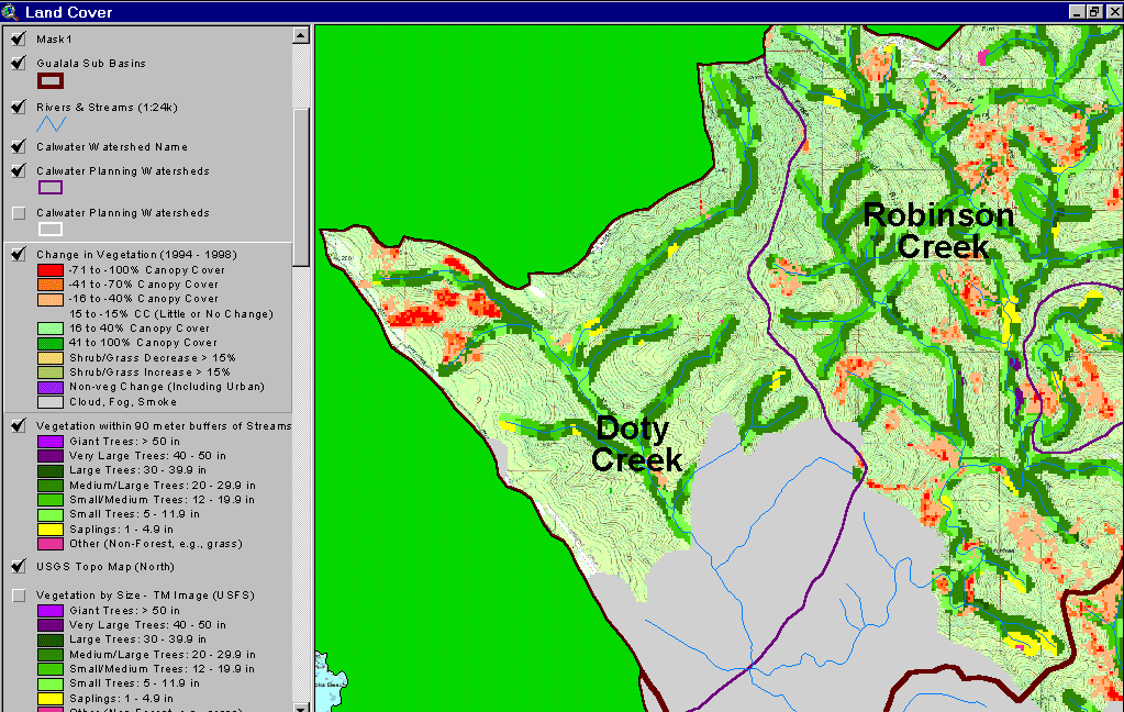 Click on image to enlarge (130K).
To learn more about this topic click Info Links
| www.krisweb.com |