
| Area | North Fork |
| Topic | USFS Riparian Tree Size Classes: Stewarts Creek CalWater 1994 |
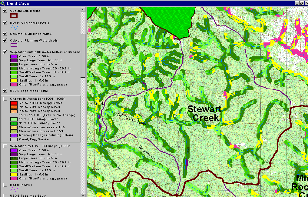
As of 1994, the riparian zone of the Stewart Creek Calwater had a substantial component of Medium/Large Trees (20-29.9 inch diameter) along the mainstem North Fork, a tributary to the mainstem of a large mainstem tributary to the south and in upper Stewarts Creek proper (mid-right of Calwater). Other reaches of the North Fork Gualala show areas with trees less than five inches (Saplings) and Small Trees (5-11.9" diameter), which promotes stream warming. See Picture #2 to see 1994-1998 Landsat change scene detection for Stewart Creek Calwater riparian areas. Data from USFS Spatial Analysis Lab Sacramento as copied from the KRIS Gualala Map project.
This image is the same as Picture #1, showing the Stewart Creek Calwater with a 90 meter buffer riparian zone based on Landsat, but in this view the change in vegetation between 1994 and 1998 is also presented. The "change scene detection" is provided by CDF FRAP and is based on the same 1994 Landsat imagery as the USFS classification but also a 1998 Landsat. Red and orange indicate intensive timber harvests within a 90-meter buffer next to the mainstem North Fork and tributaries. Also of concern are the steep inner gorge areas harvested, such as that downstream of Hayfield Creek, which are not protected as extensions of riparian zones by California Forest Practice Rules. Such areas are no longer open to timber harvest on Federal lands in these areas because of erosion risk and potential for large wood recruitment.
 Click on image to enlarge (190K).
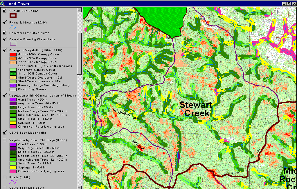 Click on image to enlarge (195K).
To learn more about this topic click Info Links
| www.krisweb.com |