
| Area | North Fork |
| Topic | USFS Tree Size Classes: Billings Creek CalWater 1994 |
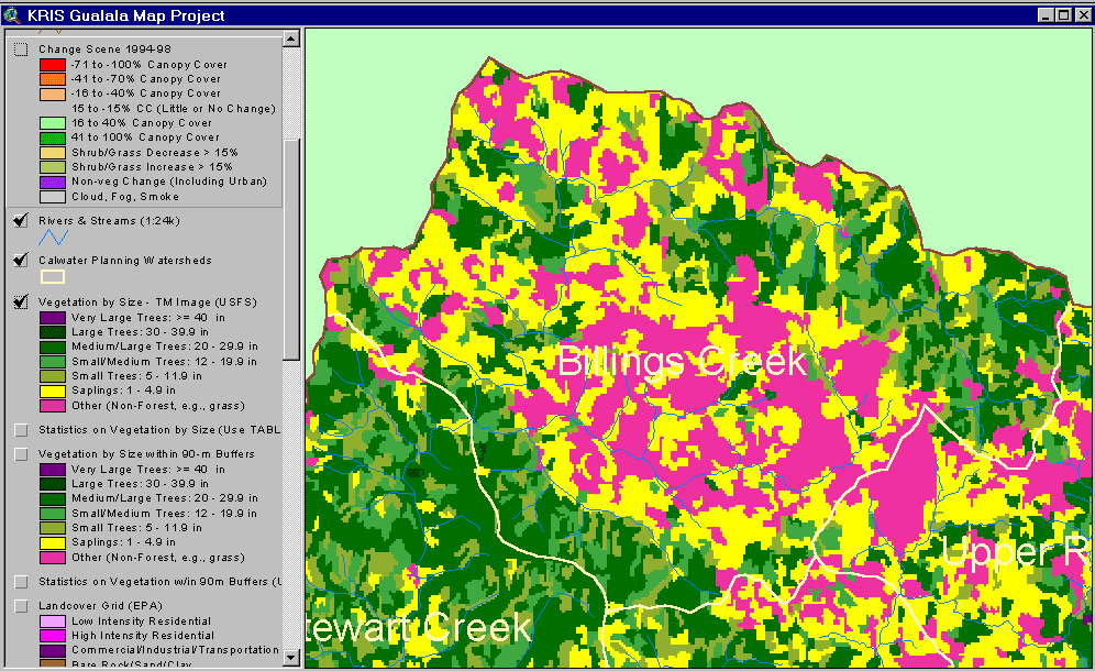
The image above shows USFS vegetation stand types for the Billings Creek Calwater planning watershed based on a 1994 Landsat image. The stand types are only accurate at the one-hectare scale. Patches of the basin show as Non-Forest partially as a result of natural grasslands. Although some Saplings (<5" diameter) may be in part associated with grasslands, in combination with Small Trees (5-11" diameter), they may also represent some areas of recent timber harvest. See Info Links for more information. Taken from the KRIS Gualala Map project.
The image above shows changes in vegetation from 1994 to 1998 according to Landsat images as derived by the California Department of Forestry FRAP division from the KRIS Gualala Map project. Changes in vegetation were mostly in the direction of canopy reduction with harvest throughout the Billings Creek Calwater. Fog obscured the 1998 Landsat image in the southwest of the basin and is shown in gray.
 Click on image to enlarge (64K).
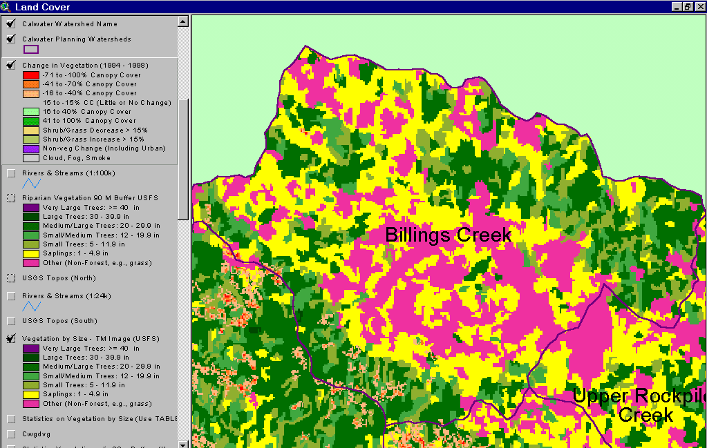 Click on image to enlarge (62K).
To learn more about this topic click Info Links
| www.krisweb.com |