
| Area | North Fork |
| Topic | USFS Tree Size Classes: Robinson Creek CalWater 1994 |
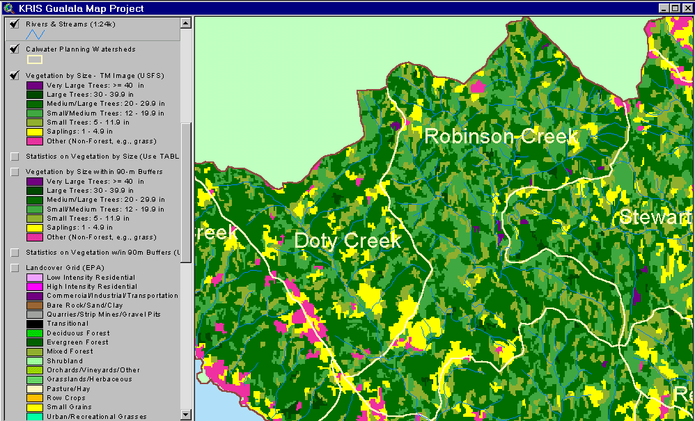
The image above shows USFS vegetation stand types for the Robinson Creek Calwater planning watershed based on a 1994 Landsat image. The stand types are only accurate at the one-hectare scale. The largest vegetative component of the watershed as of 1994 was Medium-Large Trees (20-29.9" diameter), which were well distributed throughout the watershed. Very recently logged parts of the basin show as patches of Non-Forest and Saplings (<5" diameter). See Info Links for more information. Taken from the KRIS Gualala Map project.
The image above shows changes in vegetation from 1994 to 1998 according to Landsat images as derived by the California Department of Forestry FRAP division from the KRIS Gualala Map project. Changes in vegetation were mostly in the direction of canopy reduction with intense harvest in the northwestern corner of the Doty Creek Calwater. Fog obscured the 1998 Landsat image in the south of the basin and is shown in gray.
 Click on image to enlarge (73K).
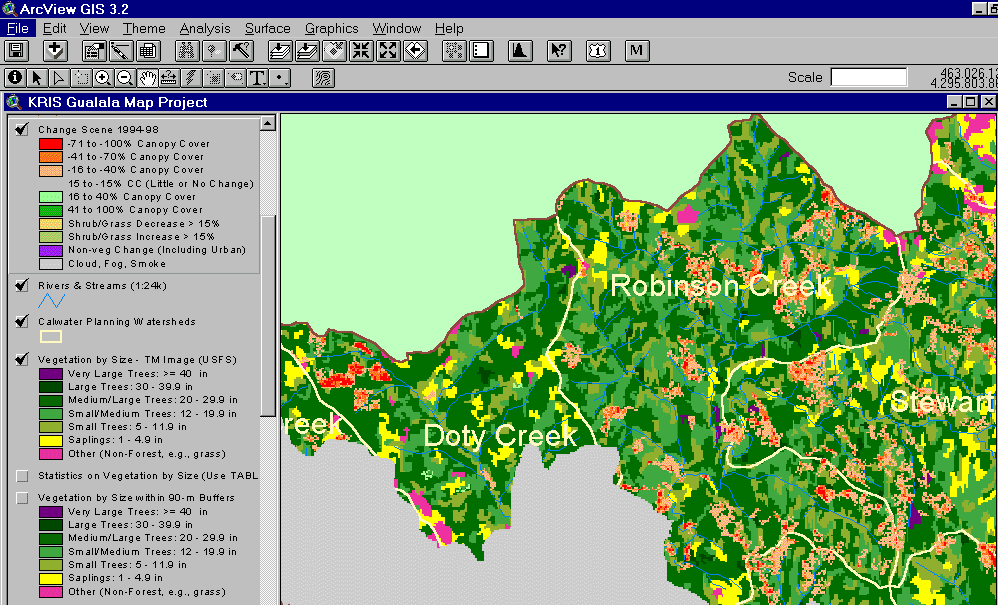 Click on image to enlarge (84K).
To learn more about this topic click Info Links
| www.krisweb.com |