
| Area | North Fork |
| Topic | Sediment: Road Densities for North Fork Gualala Calwaters |
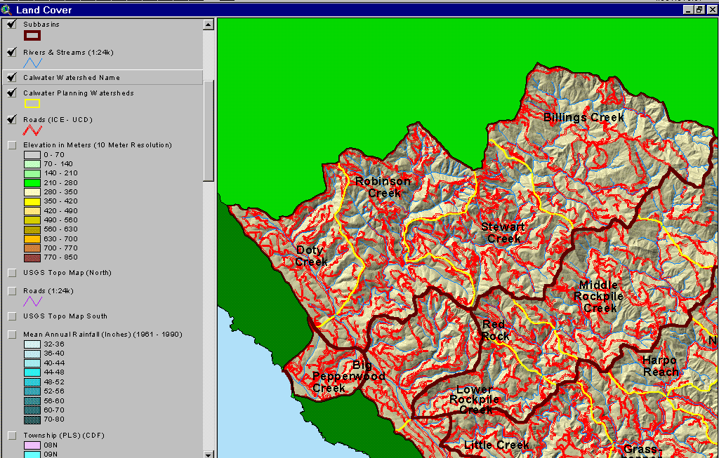
The map above shows the roads in the North Fork Gualala basin as mapped by UC Davis ICE from 2000 aerial photo graphs. The Doty Creek, Robinson Creek and Stewart Creek Calwaters all have very high road densities. Taken from the KRIS Gualala Map project.
 Click on image to enlarge (147K).
To learn more about this topic click Info Links
| www.krisweb.com |