| Area |
Rockpile Creek |
| Topic |
Rockpile Creek Basin Location Maps |
 Click on image to enlarge (246K).
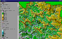
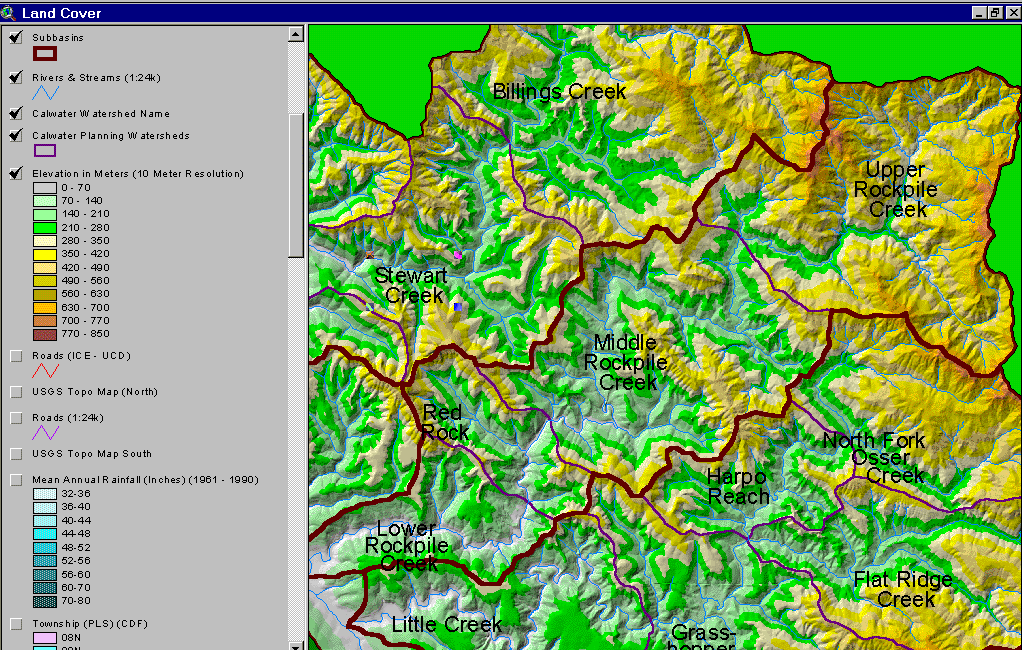
The image above is from the KRIS Gualala Map project and shows the elevation and relief of the Rockpile Creek watershed. Elevation rises in the Rockpile drainage from west to east with the highest elevation in the Upper Rockpile Creek Calwater.
 Click on image to enlarge (124K). Click here to display a larger version (532K).
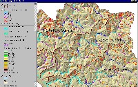
The image above from the KRIS Gualala Map project shows stream gradient for the Rockpile Creek basin. The mainstem of Rockpile Creek is less than 2% gradient and, therefore, optimal for coho salmon and steelhead spawning and rearing in the lower two thirds of the stream. Steep headwaters in the eastern portion of the Rockpile basin are over 20% in gradient, which makes them supply reaches with regard to sediment flux. Steelhead could use the valley bottom streams in the eastern portion of the Rockpile basin.
 Click on image to enlarge (197K).
Road densities in the eastern portion of the Rockpile Creek basin are low because of the extreme difficulty in building and maintaining roads in the Earthflow terrain of the Central Belt Franciscan, which underlies this area. Road densities are much higher in the western portion of the basin and many are associated with timber harvest.
 Click on image to enlarge (106K).
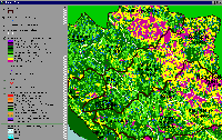
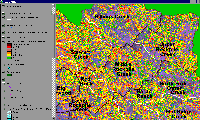
The image above is from the KRIS Gualala Map project and shows vegetation for the Rockpile Creek sub basin as interpreted from a 1994 Landsat image by the U.S. Forest Service Remote Sensing Lab. Extensive patches of Non-Forest and Saplings (trees <5") in Upper Rockpile and the eastern portion of Middle Rockpile Calwaters is in response to Central Belt Franciscan formation but similar patches in the west of the basin may be associated with recent clear cuts. Medium/Large Trees (20-29.9" diameter) and Small-Medium Trees (12-19.9" diameter) in the western portion of the basin are associated with highly productive forest soils.
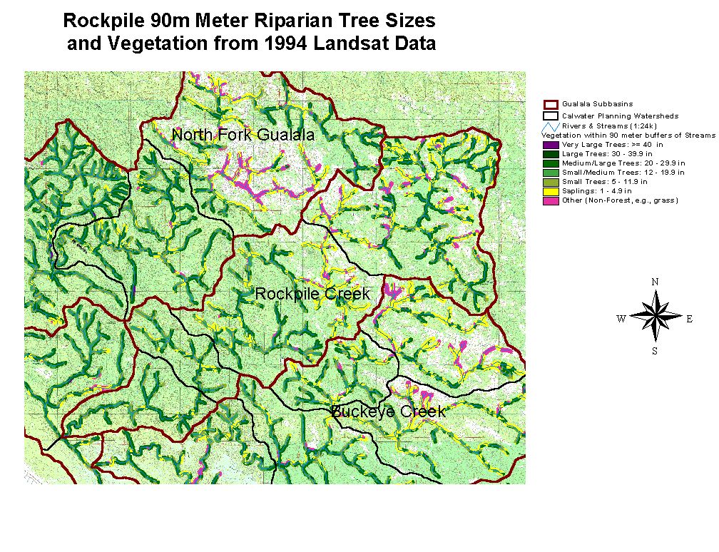
 Click on image to enlarge (152K). Click here to display a larger version (279K).
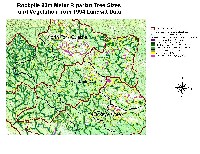
The image above shows riparian tree size within 90 meters of either side of Rockpile Creek and its tributaries derived from a 1994 Landsat data. While upper Rockpile Creek may have naturally high components of small diameter trees and Non Forest due to bedrock geology, the young age of the riparian forest in the lower Rockpile basin is owing to timber harvest. Lack of large diameter trees and predominance of hardwoods leaves Rockpile Creek open to warming and indicates a lack of potential large wood for recruitment into the stream for salmonid habitat.
 Click on image to enlarge (204K).
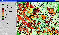
The map image above is of the shallow landslide stability model (SHALSTAB) for Rockpile generated from a ten-meter digital elevation model (DEMs) with higher risk of shallow landslides coded in colors from yellow to red. High-risk slopes are common in this basin with the Red Rock Calwater almost entirely covered with debris slide prone areas. Inner gorges show as high risk throughout the watershed. Less debris slide risk is shown for the Upper Rockpile drainage, as the Central Belt Franciscan which underlies it, is more prone to earthflows. The SHALSTAB run was performed by Dr. Jan Derksen based on 10m DEM data provided by the California Department of Forestry FRAP division and following the methods of Dietrich and Montgomery.
 Click on image to enlarge (177K).
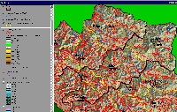
The map image above is based on California Department of Forestry data and shows all harvests permitted in the Rockpile subbasin with individual Calwater Planning Watersheds labeled.
To learn more about this topic click Info Links

 Click on image to enlarge (246K).
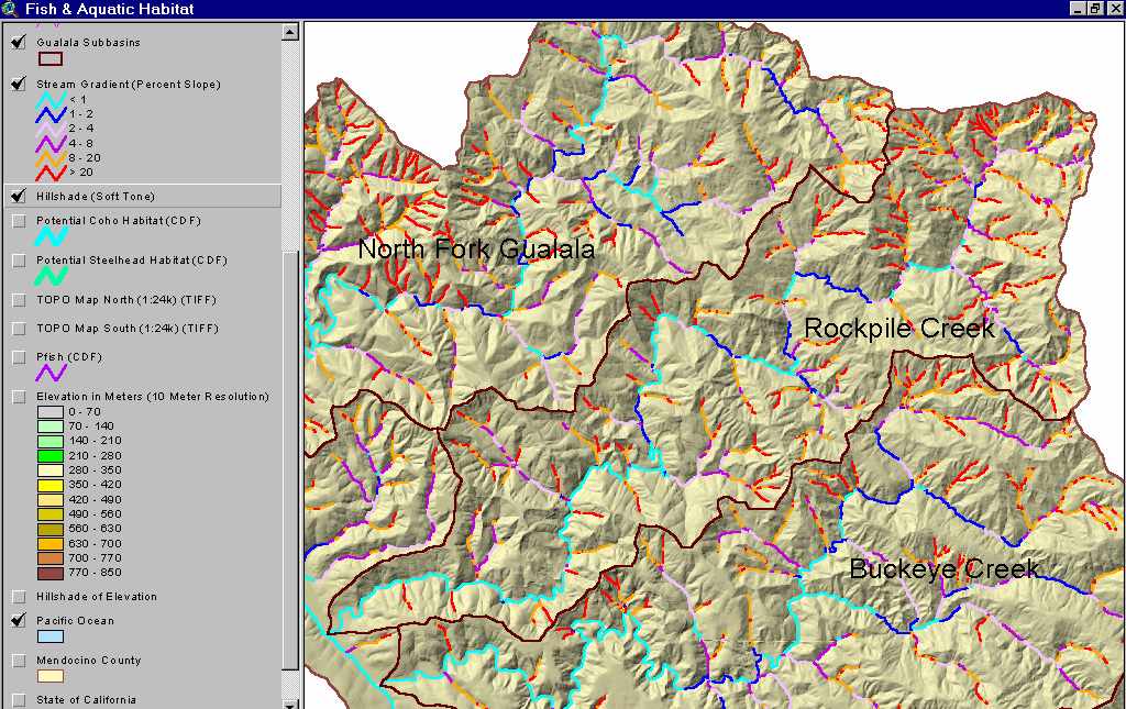 Click on image to enlarge (124K). Click here to display a larger version (532K).
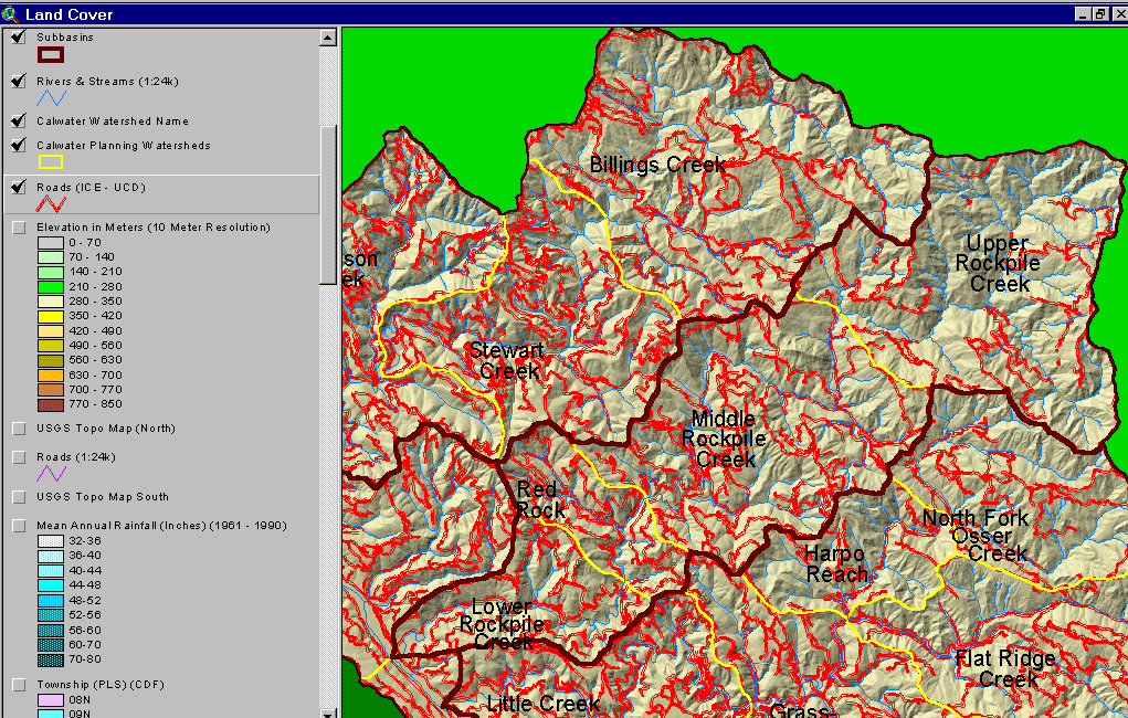 Click on image to enlarge (197K).
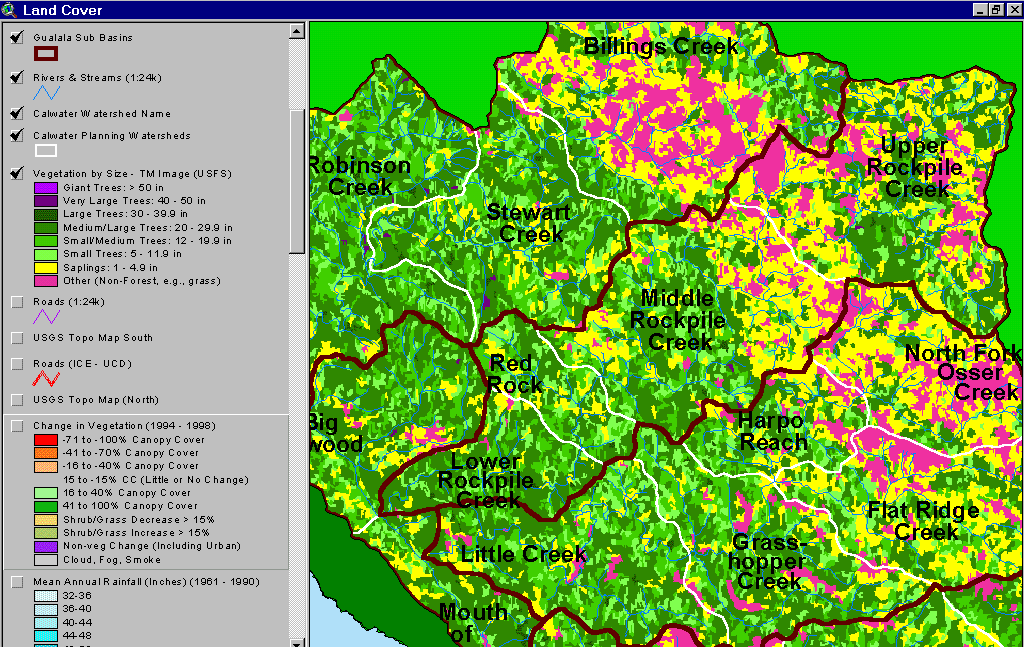 Click on image to enlarge (106K).
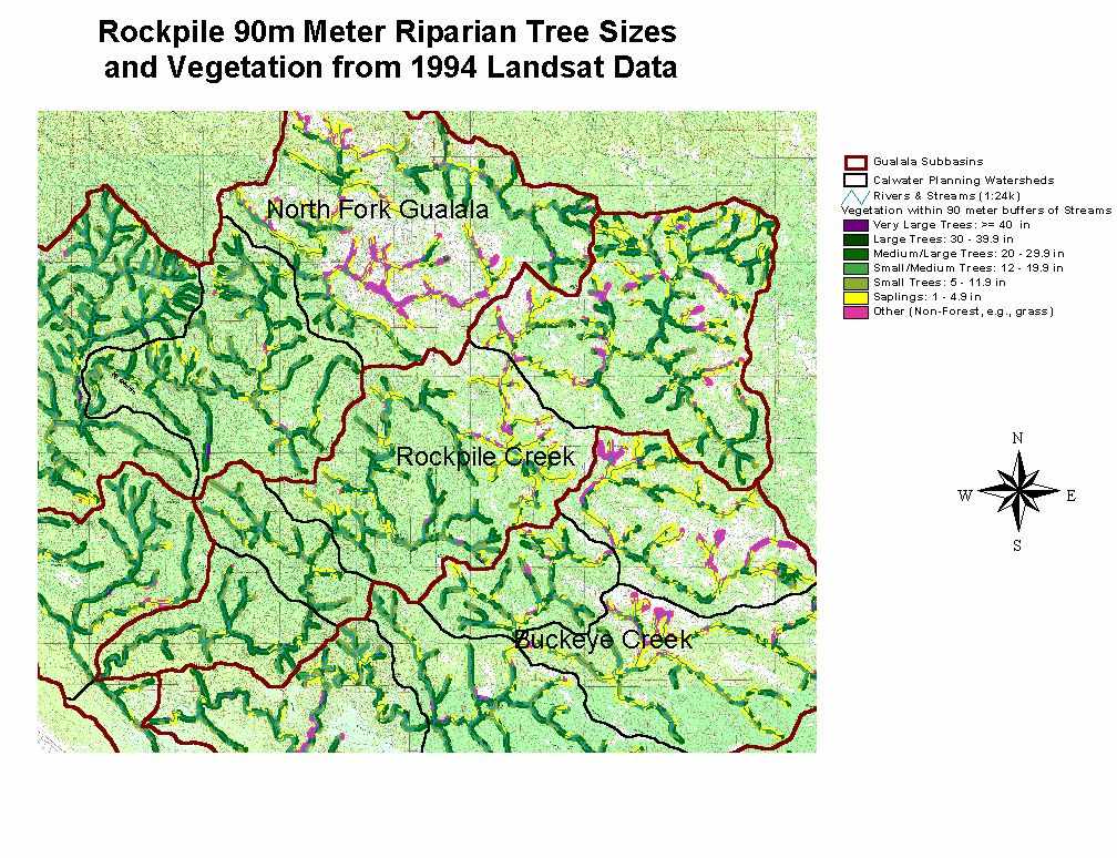 Click on image to enlarge (152K). Click here to display a larger version (279K).
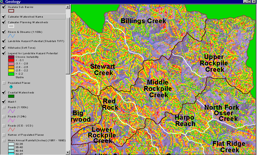 Click on image to enlarge (204K).
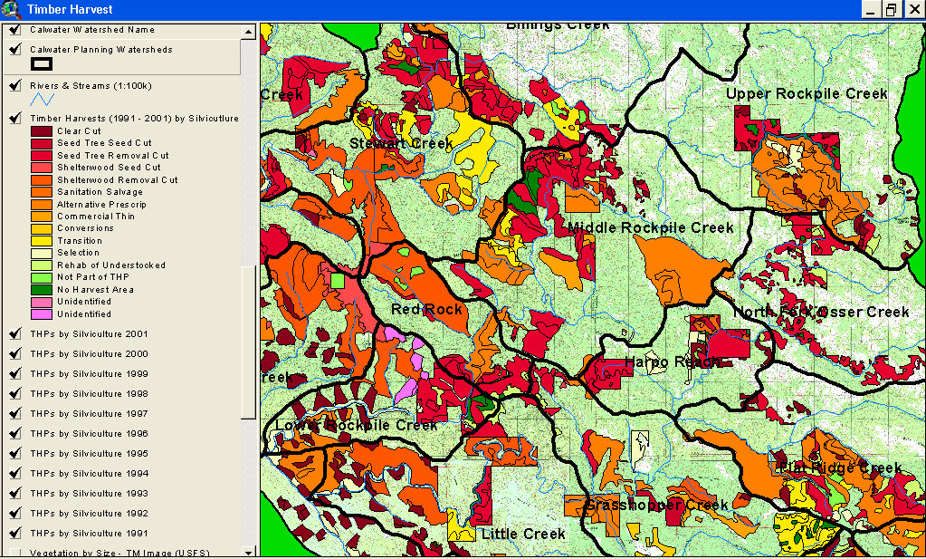 Click on image to enlarge (177K).