
| Area | Rockpile Creek |
| Topic | Habitat Typing: Embeddedness for Rockpile Creek |
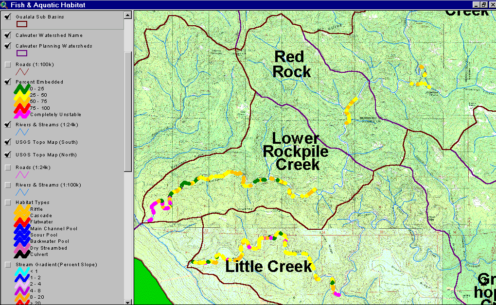
The map above is derived from data provided by the California Department of Fish and Game and shows the embeddedness in pool tail crests in reaches of Rockpile Creek surveyed in 2001. Note that embeddedness values show slightly (25-50%) to moderately impaired ranges for salmonids in the two upper reaches of Rockpile Creek surveyed, but the frequency of optimal spawning gravels (<25% embedded) increases downstream. The dry reaches of stream surveyed just above the convergence with the SF Gualala are shown as unsuitable for spawning, a fifth CDFG category. The lower end of a large stream like Rockpile running underground is a sign of aggradation. Image taken from the KRIS Gualala Map project.
 Click on image to enlarge (204K).
To learn more about this topic click Info Links
| www.krisweb.com |