
| Area | Rockpile Creek |
| Topic | USFS Riparian Tree Size Classes: Middle Rockpile CalWater 1994 |
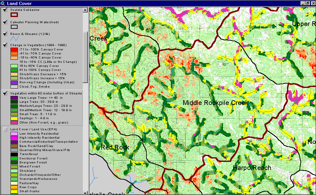
The image above shows USFS vegetation stand tree size classes for the riparian zone of the mainstem Rockpile Creek in the Middle and Red Rock Calwater planning watersheds based on a 1994 Landsat image. The stand types are only accurate at the one-hectare scale and the buffer width is 90 meters. The riparian along the mainstem Rockpile Creek has Medium/Large Trees (20-29.9" diameter) interspersed in patches as it comes off mélange terrain below Burnt Ridge Creek all the way through the Red Rock Calwater. This reach also has an equal amount of early seral riparian areas dominated by Saplings (<5" diameter), Small Trees (5-11.9" diameter) and Small/Medium Trees (12-19.9"diameter), which would leave this reach subject to warming. Eastern riparian reaches show as Non-Forest, Saplings and Small Trees as a result of natural grasslands. See Info Links for more information. Taken from the KRIS Gualala Map project.
 Click on image to enlarge (194K).
To learn more about this topic click Info Links
| www.krisweb.com |