
| Area | Rockpile Creek |
| Topic | Habitat Typing: Habitat Categories by Length for Rockpile Creek |
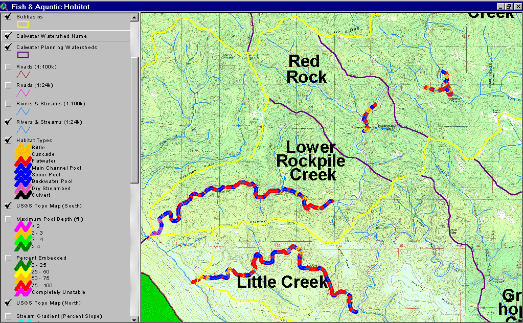
The map above is derived from data provided by the California Department of Fish and Game and shows the habitat types by pool, riffles, runs (flatwater) and dry reaches. Note that pool frequency is low in the two upper reaches of Rockpile Creek surveyed, but pool frequency increases downstream. However, many habitat units were dry in the reach just above the convergence with the SF Gualala. The lower end of a large stream like Rockpile running underground is a sign of aggradation. Image taken from the KRIS Gualala Map project.
 Click on image to enlarge (205K).
To learn more about this topic click Info Links
| www.krisweb.com |