
| Area | South Fork |
| Topic | Temperature: Min, Max and Average in Lower South Fork 2000 |
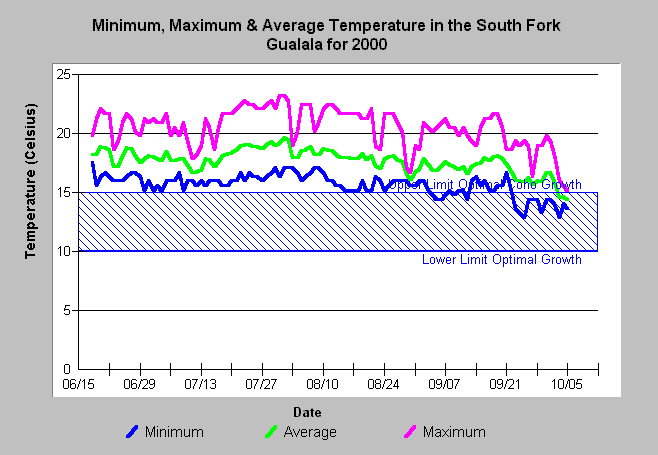
| Caption: This chart shows minimum, maximum, and average daily temperature for the lower South Fork Gualala River in 2000 at a temperature monitoring station just downstream of Big Pepperwood Creek. Minimum temperatures exceeded the optimum range for salmonid growth from June through August. Daily temperature variation exceeded six degrees Celsius for most of the summer period. Data collected by Gualala River Watershed Council. See Info Links for more information. | |
 |
To learn more about this topic click Info Links .
To view a table of information about this data click Metadata .
To view the table with the chart's data, click Chart Table web page.
To download the table with the chart's data, click tempc_grwc_2000_daily.db (size 63,488 bytes) .
To view the table with the chart's source data, click Source Table web page.
To download the table with the chart's source data, click tempraw_grwc_2000.dbf (size 1,737,254 bytes)
| www.krisweb.com |