
| Area | South Fork |
| Topic | Gualala South Fork Location Maps |
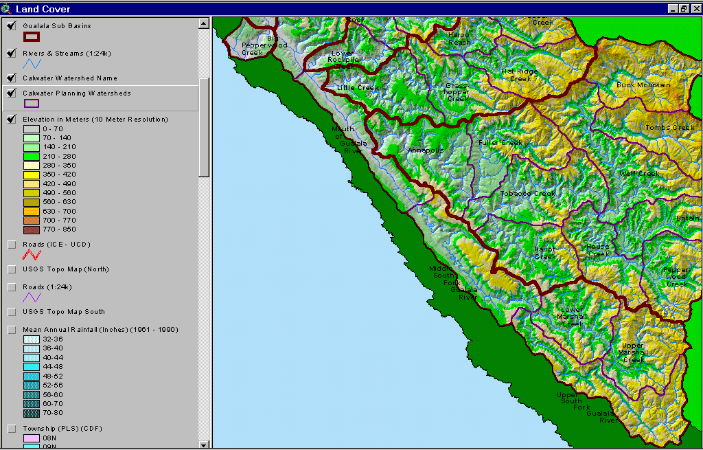
The image above is from the KRIS Gualala Map project and shows the elevation of the South Fork Gualala watershed. The South Fork basin follows the San Andreas Fault rift zone and is mostly at very low elevation. Higher portions of the basin in the south are plateaus of Ohlsen Ranch Formation, which are stable on flat areas but very unstable and prone to gully erosion on their edges.
The image above comes from the KRIS Gualala Map project and shows roads in the South Fork Gualala basin. Road densities are low in the most areas of the upper South Fork. Road densities are highest in industrial timberland holdings in the northern part of the watershed, particularly the Big Pepperwood Calwater. The road data were generated by the University of California Davis ICE project for the California Water Resources Control Board as part of the Gualala TMDL.
The image above is from the KRIS Gualala Map project and shows South Fork basin vegetation as interpreted from a 1994 Landsat image by the U.S. Forest Service Remote Sensing Lab in Sacramento. The Ohlsen Formation underlies the southeastern part of the South Fork Gualala basin, which is associated with Non-Forest and Saplings vegetation signatures. A few Very Large or Large Trees remain in the Middle South Fork Calwater, where there has been less recent active timber harvest.
The image above comes from the KRIS Gualala Map project and shows timber harvest permits as mapped by the California Department of Forestry by silvicultural technique from 1991-2001. Big Pepperwood Creek has the most active timber harvest permitting in the lower South Fork sub-basin over the last decade but timber harvest permitting in the lower middle area (Mouth of the Gualala Calwater) have also been high. The timber harvests shown above are for the lower basin and have been approved but may not have been implemented. See Picture #5 for upper South Fork THPs.
The image above comes from the KRIS Gualala Map project and shows timber harvest permits as mapped by the California Department of Forestry by silvicultural technique from 1991-2001 for the upper South Fork Gualala sub-basin.
The map image above is of the shallow landslide stability model (SHALSTAB) for the SF Gualala generated from a ten-meter digital elevation model (DEMs) with higher risk of shallow landslides coded in colors from yellow to red. The highest risk slopes are concentrated in the Big Pepperwood Calwater, although slopes are also susceptible to debris sliding in areas of the Lower and Upper Marshall Calwaters. Inner gorge locations along the South Fork also show as high risk in the Middle SF Gualala Calwater. The SHALSTAB run was performed by Dr. Jan Derksen based on 10m DEM data provided by the California Department of Forestry FRAP division and following the methods of Dietrich and Montgomery. See Background page on Slope Stability for more information.
The image above is from the KRIS Gualala Map project and shows South Fork basin vegetation for a 90-meter riparian buffer strip as interpreted from a 1994 Landsat image by the U.S. Forest Service Remote Sensing Lab in Sacramento. The high Non-Forest, Sapling (trees 5"diameter) and other small diameter classes is in part owing to Ohlsen Formation, which underlies the southeastern part of the South Fork Gualala basin. Conditions along the South Fork itself vary from Small Trees (5-11.9" diameter), Small/Medium (12-19.9"diameter) and Medium/Large Trees (20-29.9" diameter). The Middle South Fork Calwater has a component Very Large (>40") and Large Trees (30-39.9" diameter), which is unique in the Gualala. This could be very important in large wood recruitment and maintaining cool water in this reach. No temperature data was available specifically for this area.
This image shows a topographic map of the Upper South Fork Gualala overlain with the roads and stream crossing themes and change scene detection. The latter is derived by comparison of 1994 and 1998 Landsat images. The red and orange along the ridge at right represents conversion of forest land to vineyards, which is also occurring in Fuller Creek, uplands near Anapolis and in House Creek. Image from the KRIS Gualala Map project.
 Click on image to enlarge (187K).
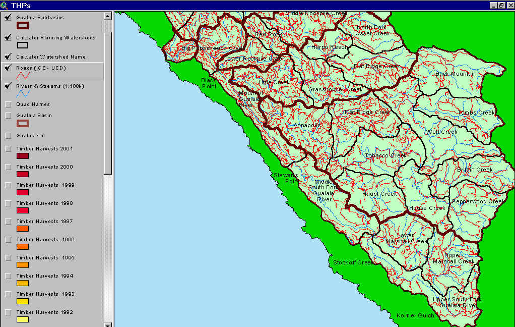 Click on image to enlarge (74K).
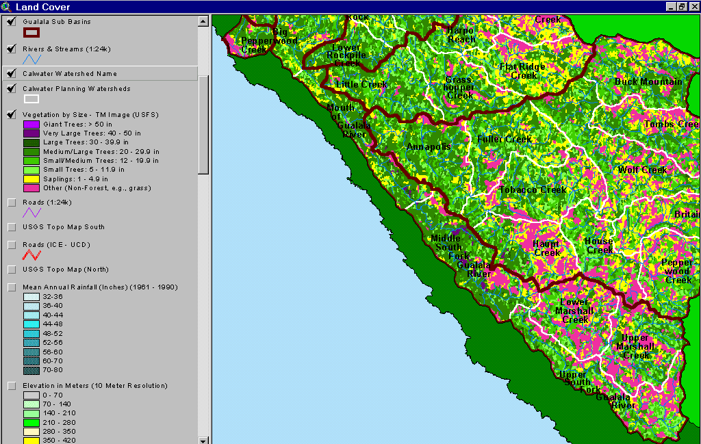 Click on image to enlarge (103K).
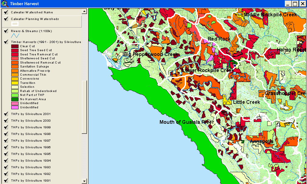 Click on image to enlarge (122K).
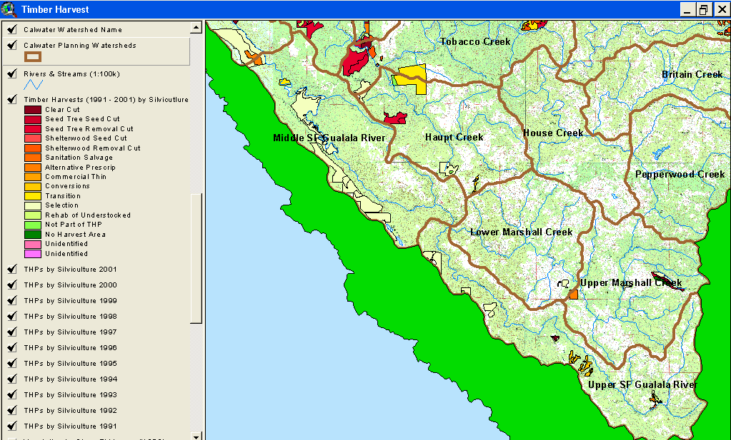 Click on image to enlarge (132K).
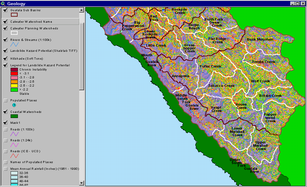 Click on image to enlarge (141K).
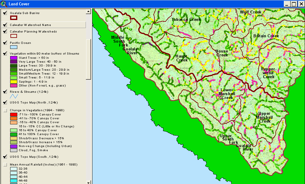 Click on image to enlarge (120K).
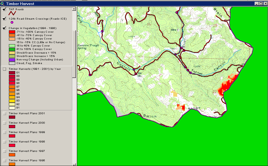 Click on image to enlarge (103K).
To learn more about this topic click Info Links
| www.krisweb.com |