
| Area | South Fork |
| Topic | Timber Harvest: Percent Harvested SF/Main Gualala Calwaters 1991-2001 |
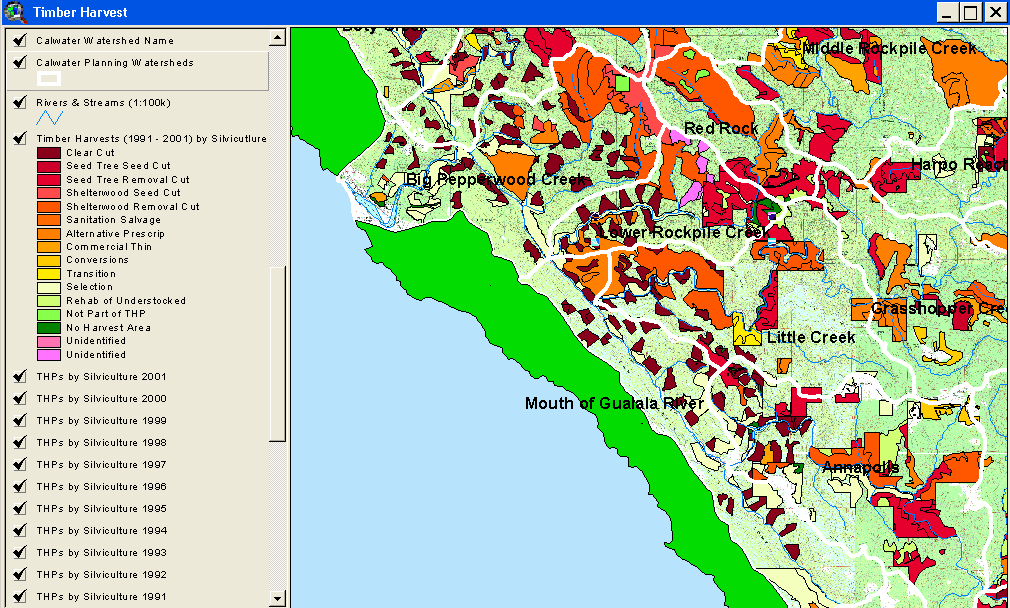
The image above comes from the KRIS Gualala Map project and shows timber harvest permits as mapped by the California Department of Forestry by silvicultural technique from 1991-2001. Big Pepperwood Creek has the most active timber harvest permitting in the lower South Fork subbasin over the last decade but timber harvest permitting in the lower middle area (Mouth of the Gualala Calwater) have also been high. The timber harvests shown above are for the lower basin and have been approved but may not have been implemented. See Picture #5 for upper South Fork THPs.
Map of timber harvest plans approved between 1991 and 2001 in the upper South Fork Gualala subbasin according to the California Department of Forestry. From KRIS Map project.
 Click on image to enlarge (122K).
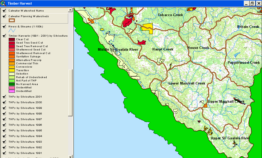 Click on image to enlarge (132K).
To learn more about this topic click Info Links
| www.krisweb.com |