
| Area | Wheatfield |
| Topic | Habitat: All Wheatfield Gualala CDFG Survey Reach Lengths 2001 |
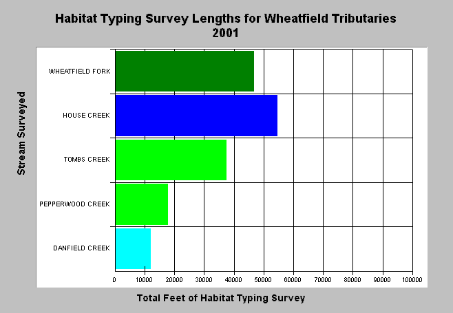
| Caption: The chart above shows the total length in feet of all California Department of Fish and Game 2001 Habitat Typing surveys for the Wheatfield Gualala basin. House Creek had the longest survey reach with over ten miles of stream surveyed. Longer surveys convey a more accurate picture of habitat conditions. Stream orders of tributaries using the Strahler method were determined using 1:24000 USGS Topo maps and are color coded above with dark green = 5th order, dark blue = 4th order, light green = 3rd order, light blue = 2nd order. The survey lengths of lower order streams are usually smaller because of shorter stream length overall. See Info Links for more information. | |
 |
To learn more about this topic click Info Links .
To view a table of information about this data click Metadata .
To view the table with the chart's data, click Chart Table web page.
To download the table with the chart's data, click stream_sum_wf.dbf (size 7,102 bytes) .
To view the table with the chart's source data, click Source Table web page.
To download the table with the chart's source data, click streamsum_m_gua_habdata.dbf (size 11,384 bytes)
| www.krisweb.com |