
| Area | Wheatfield |
| Topic | Temperature: Floating Weekly Average of Wheatfield Fk and Fuller 2000 |
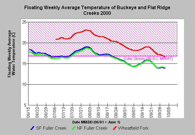
| Caption: This chart shows the floating weekly average temperature at sites in the South and North Fork Fuller Creek and the mainstem Wheatfield Fork taken in 2000 by Gualala River Watershed Council. Fuller Creek is too warm to support coho when compared to the known tolerance of the species in northern California (Welsh, 2001). The Wheatfield Fork was at acutely stressful or lethal temperatures for all salmonids. See Info Links for more information. | |
 |
To learn more about this topic click Info Links .
To view a table of information about this data click Metadata .
To view the table with the chart's data, click Chart Table web page.
To download the table with the chart's data, click tempc_grwc_2000_daily.db (size 63,488 bytes) .
To view the table with the chart's source data, click Source Table web page.
To download the table with the chart's source data, click tempraw_grwc_2000.dbf (size 1,737,254 bytes)
| www.krisweb.com |