| Area |
Wheatfield |
| Topic |
Wheatfield Fork Basin Maps |
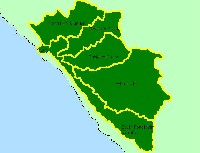 Click on image to enlarge (46K).
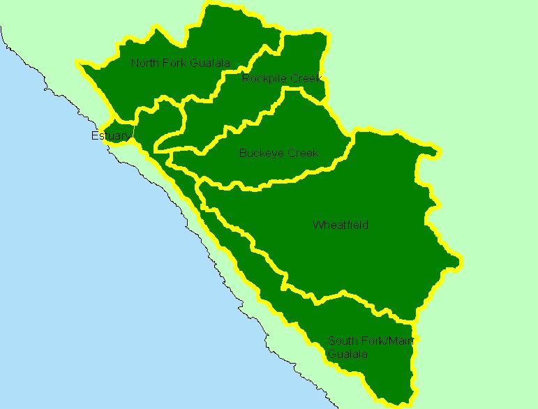
The image above is from the KRIS Gualala Map project and shows the Wheatfield Fork Gualala River watershed relative to the other large planning areas used by the North Coast Watershed Assessment Program. The Wheatfield is by far the largest Gualala sub basin. The estuary sub basin is used in KRIS but is part of the South Fork/Main sub basin for NCWAP.
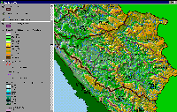 Click on image to enlarge (226K).
The image above is from the KRIS Gualala Map project and shows the elevation and relief of the Wheatfield Fork Gualala River watershed. While relief is gradual in the west in the Annapolis Calwater and western Fuller Creek and Tobacco Creek Calwaters, the eastern portion of the Wheatfield drainage rises in elevation.
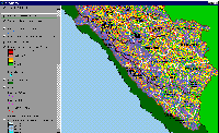 Click on image to enlarge (141K).
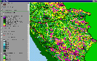
The map image above is of the shallow landslide stability model (SHALSTAB) generated from a ten-meter digital elevation model (DEMs) for the Wheatfield Fork Gualala with higher risk of shallow landslides coded in colors from yellow to red. The concentration of high risk areas are in the eastern Fuller and Tobacco Creek Cal waters, the northern House Creek Calwater, the western Tombs Creek Calwater and the entire Wolf Creek Calwater. Inner gorge locations and headwater swales show a pattern of high risk throughout the Wheatfield Fork basin. The SHALSTAB run was performed by Dr. Jan Derksen based on 10m DEM data provided by the California Department of Forestry FRAP division.
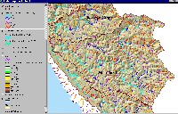 Click on image to enlarge (99K). Click here to display a larger version (534K).
Much of the Wheatfield Fork Gualala River is of mild gradient with reaches less than 2% extending up to Tombs Creek and tributaries such as House, Haupt and Fuller Creeks also having extensive low gradient reaches. Coho were known to inhabit the latter three creeks but documentation of coho presence in the upper Wheatfield is lacking. The Wheatfield does not have as many extremely steep headwaters (>20% gradient) as planning areas to the north, with these reaches being confined mostly to the southern and eastern border of the watershed. Image from the KRIS Gualala Map project.
 Click on image to enlarge (111K).
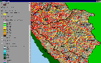
The image above is from the KRIS Gualala Map project and shows vegetation for the Wheatfield Fork watershed as classified from a 1994 Landsat image by the U.S. Forest Service Remote Sensing Lab in Sacramento. The eastern part of the Wheatfield basin is underlain by Central Belt Franciscan terrain and is, therefore, naturally in grasslands, oak woodlands and mixed oak. The Ohlsen Formation, which extends into Haupt Creek, also has similar vegetation patterns. The best coniferous timberland is in the western portions of the Wheatfield Fork basin in the Annapolis and Fuller Creek Calwaters. Small diameter tree size classes predominate because of past and recent timber harvest. See Vegetation and Timber Size Class topics for more in depth information.
 Click on image to enlarge (166K).
The image above comes from the KRIS Gualala Map project and shows timber harvests as mapped by the California Department of Forestry by year from 1991-2001. The timber harvests shown above are for the entire basin and have been approved but may not have been implemented. Note that harvests are concentrated in the western portion of the basin, primarily in the Annapolis and Fuller Creek Calwaters.
 Click on image to enlarge (189K).
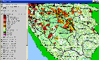
The image above comes from the KRIS Gualala Map project and shows roads and Calwaters for the Wheatfield Fork Gualala River watershed. Road densities are low in the highly erodible earthflow terrain of the eastern portions of the watershed. Road densities are highest in industrial timberland holdings in the western and northwestern portions of the basin in the Fuller Creek and Annapolis Calwaters. Fuller Creek is currently undergoing extensive road upgrading and decomissioning to decrease sediment yield to streams. The road data were generated by the University of California Davis ICE project for the California Water Resources Control Board as part of the Gualala TMDL.
To learn more about this topic click Info Links

 Click on image to enlarge (46K).
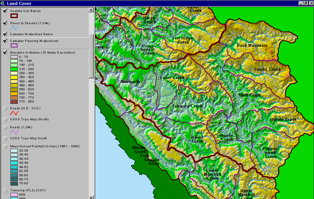 Click on image to enlarge (226K).
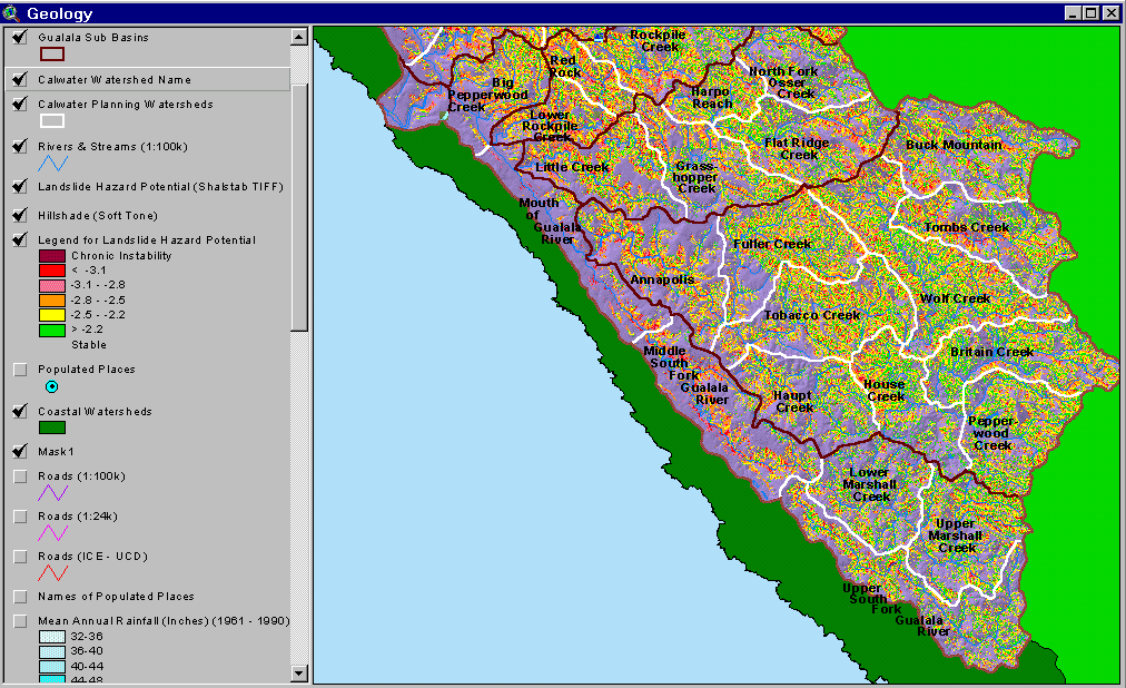 Click on image to enlarge (141K).
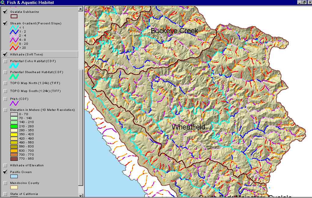 Click on image to enlarge (99K). Click here to display a larger version (534K).
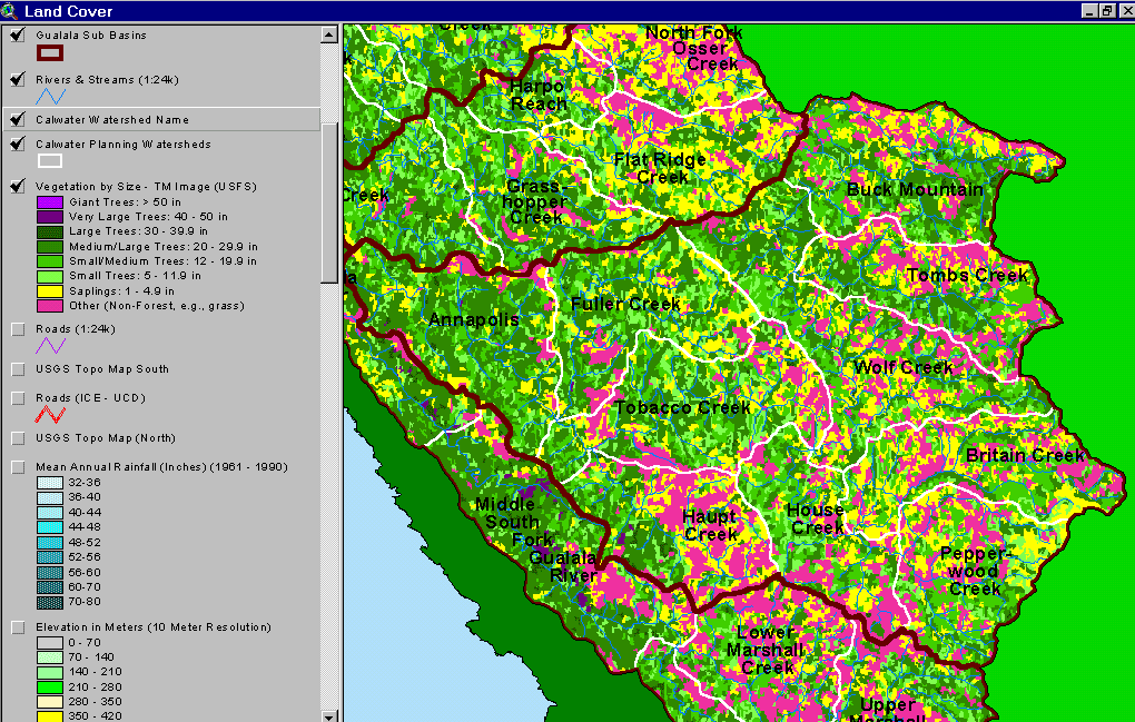 Click on image to enlarge (111K).
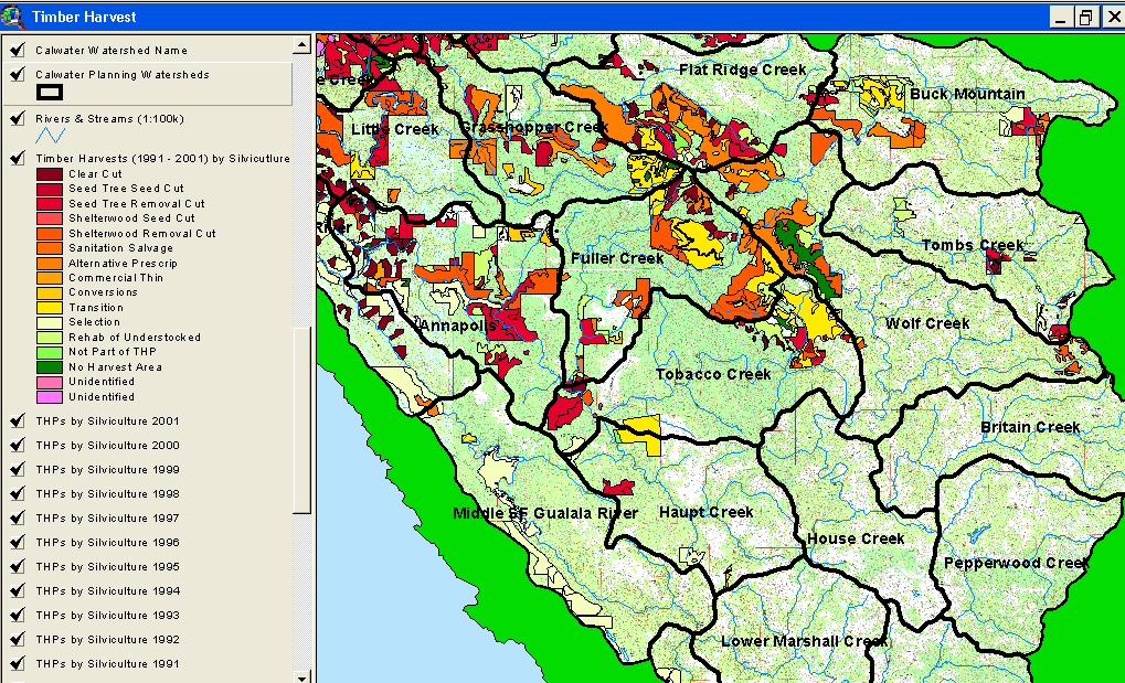 Click on image to enlarge (166K).
 Click on image to enlarge (189K).
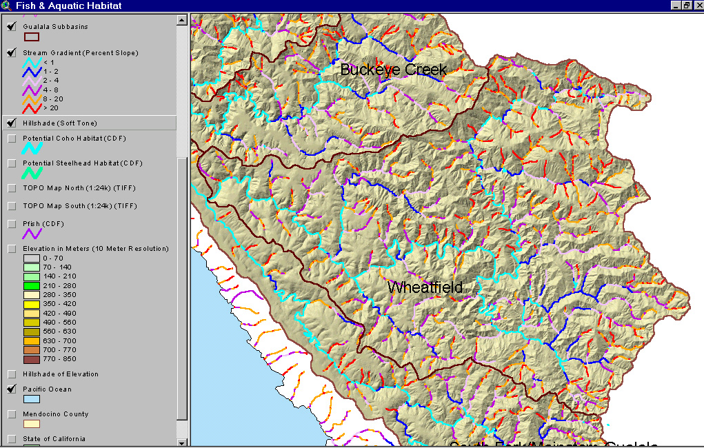