
| Area | Wheatfield |
| Topic | USFS Riparian Tree Size Classes: House Creek CalWater 1994 |
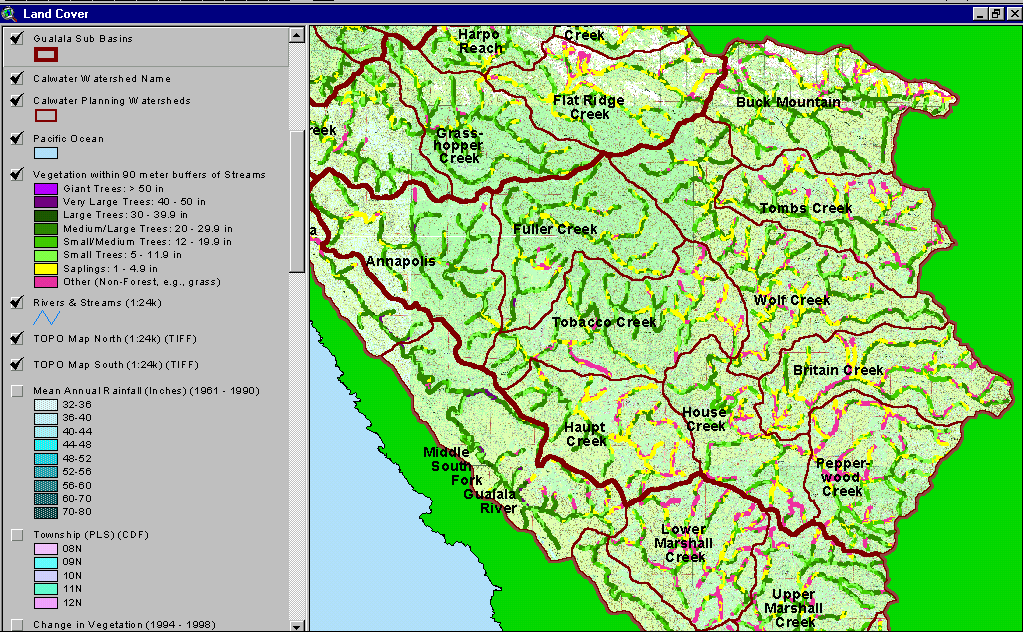
The image above shows USFS vegetation stand types for the riparian zone of all Wheatfield Fork Calwater planning watersheds based on a 1994 Landsat image. The stand types are only accurate at the one-hectare scale and the buffer width is 90 meters. Much of the riparian in eastern Calwaters shows as Non-Forest, Saplings and Small Trees as a result of natural grasslands in mťlange terrain of the Central Belt Franciscan. Annapolis, Fuller Creek, western Tobacco Creek and western Haupt Creek all have extensive high site potential forest soils. Small diameter trees in the riparian zone of these latter areas are indicative of past and recent timber harvest. Image taken from the KRIS Gualala Map project. See Info Links for more information.
 Click on image to enlarge (164K).
To learn more about this topic click Info Links
| www.krisweb.com |