
| Area | Wheatfield |
| Topic | USFS Tree Size Classes: Tobacco Creek CalWater 1994 |
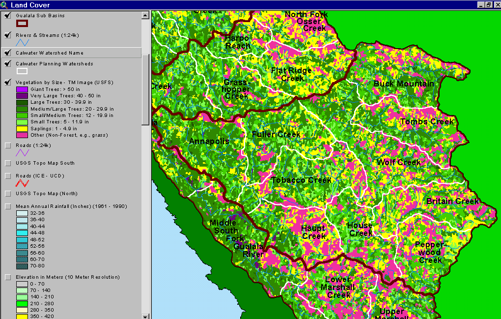
The image above is from the KRIS Gualala Map project and shows vegetation for the Wheatfield Fork watershed as classified from a 1994 Landsat image by the U.S. Forest Service Remote Sensing Lab in Sacramento. The eastern part of the Wheatfield basin is underlain by Central Belt Franciscan terrain and is, therefore, naturally in grasslands, oak woodlands and mixed oak. The Ohlsen Formation, which extends into Haupt Creek, also has similar vegetation patterns. The best coniferous timberland is in the western portions of the Wheatfield Fork basin in the Annapolis and Fuller Creek Calwaters. Small diameter tree size classes predominate because of past and recent timber harvest. See Info Links for more information.
 Click on image to enlarge (111K).
To learn more about this topic click Info Links
| www.krisweb.com |