| Basin |
Humboldt Bay |
| Caption |
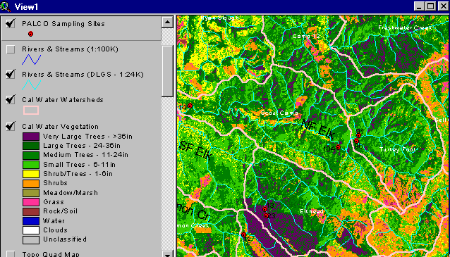
This map image of vegetation types is based 1994 Landsat data and shows vegetation types for Scout Camp Calwater Planning Watershed with predominantly early seral conditions prevailing. Map by Institute for Fisheries Resources based on data from Humboldt State University.
|
| CaptionTemplate |
[Description] |
| Description |
This map image of vegetation types is based 1994 Landsat data and shows vegetation types for Scout Camp Calwater Planning Watershed with predominantly early seral conditions prevailing. Map by Institute for Fisheries Resources based on data from Humboldt State University.
|
| Filename |
ervegpl.gif |
| Filesize |
49446 |
| Meta_Id |
VegType |
| Notefile |
humbay.htm#Seral |
| Path |
topics/er/ervegpl.gif |
| Series |
GIS: Vegetation Types in Scout Camp CW Watershed 1994 |
| SubBasin |
Elk River |