| Basin |
Humboldt Bay |
| Caption |
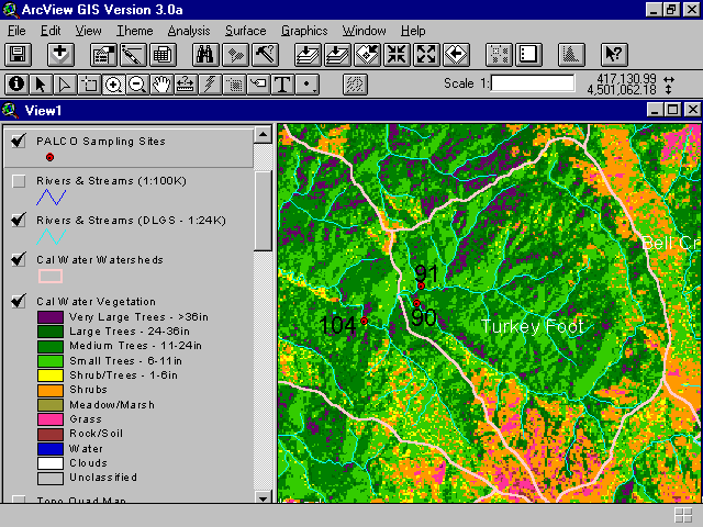
This map image shows a summary of vegetation and timber types of the Turkey Foot Calwater Planning Watershed derived from a 1994 Landsat image. The extensive areas of yellow, orange and pinks show substantial disturbance just prior to 1994 which left brush (shrubs) and grasses instead of forest types. This map image is from the Institute for Fisheries Resources but based on 1994 Landsat data interpreted by the Humboldt State University Spatial Analysis Lab. See InfoLinks for more background information. |
| CaptionTemplate |
[Description] |
| Description |
This map image shows a summary of vegetation and timber types of the Turkey Foot Calwater Planning Watershed derived from a 1994 Landsat image. The extensive areas of yellow, orange and pinks show substantial disturbance just prior to 1994 which left brush (shrubs) and grasses instead of forest types. This map image is from the Institute for Fisheries Resources but based on 1994 Landsat data interpreted by the Humboldt State University Spatial Analysis Lab. See InfoLinks for more background information. |
| Filename |
ernfavpl.gif |
| Filesize |
44996 |
| Meta_Id |
VegType |
| Notefile |
humbay.htm#Seral |
| Path |
topics/er/ernfavpl.gif |
| Series |
GIS: Vegetation Types in Turkey Foot CW Unit 1994 |
| SubBasin |
Elk River |