|
Area/Topic | Bibliography | Background | Hypotheses | Home |
Photo Pages: Meta Information
This page contains detailed information from the KRIS Photodatabase table about photos from sub-basin Freshwater Creek-Ryan Slough and series GIS: PALCO Aquatic Invertebrate, Sediment, Temperature Sampling Locations in late 1990s.
| Basin | Humboldt Bay |
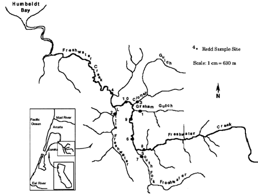
| Caption | This map is from Barnard (1992) M.S. Thesis from Humboldt State University. Locations are very similar to those chosen by PL for monitoring and thus make an interesting pre-logging comparison for fine sediment versus PL shovel samples taken starting in 1994. |
| CaptionTemplate | [Description] |
| Description | This map is from Barnard (1992) M.S. Thesis from Humboldt State University. Locations are very similar to those chosen by PL for monitoring and thus make an interesting pre-logging comparison for fine sediment versus PL shovel samples taken starting in 1994. |
| Filename | barnar.gif |
| Filesize | 30276 |
| Meta_Id | sediment |
| Notefile | humbay.htm#Sediment |
| Path | topics/fc/barnar.gif |
| Series | GIS: PALCO Aquatic Invertebrate, Sediment, Temperature Sampling Locations in late 1990s |
| SubBasin | Freshwater Creek-Ryan Slough |
| Basin | Humboldt Bay |
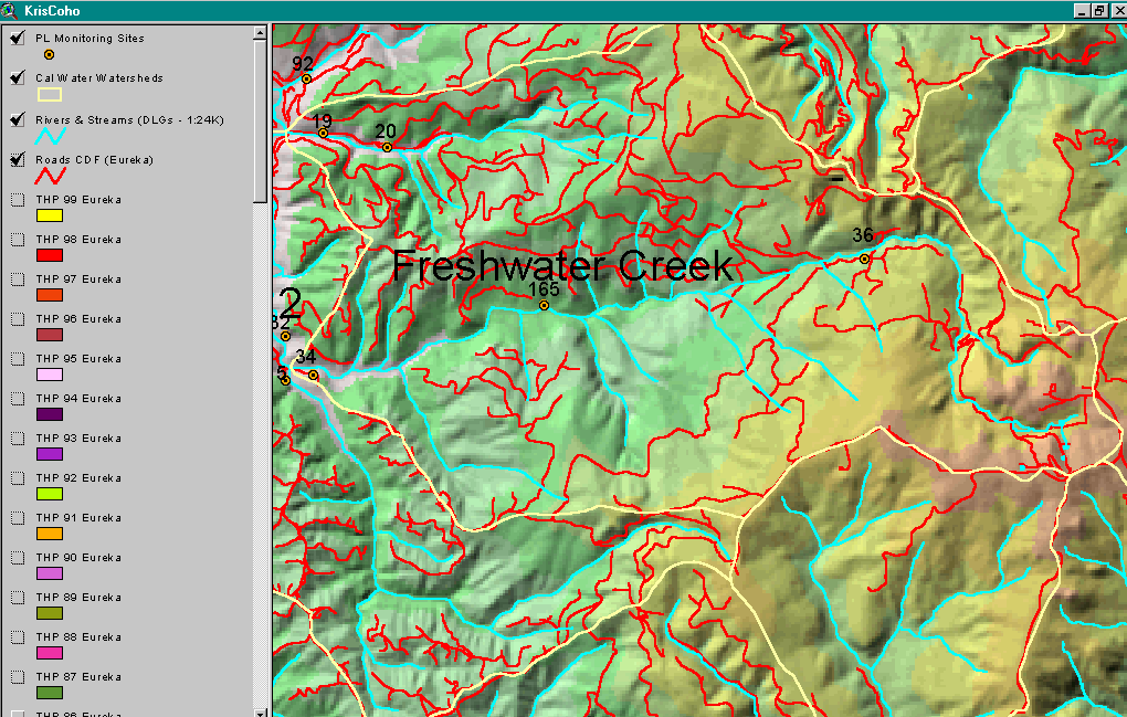
| Caption | Map image of main haul roads and county roads in the upper Freshwater Creek watershed with PL monitoring locations also displayed. Map from IFR KRIS Coho project. |
| CaptionTemplate | [Description] |
| Description | Map image of main haul roads and county roads in the upper Freshwater Creek watershed with PL monitoring locations also displayed. Map from IFR KRIS Coho project. |
| Filename | mfwroads.gif |
| Filesize | 209966 |
| Meta_Id | insects |
| Notefile | humbay.htm#aqinsects |
| Path | topics/fc/mfwroads.gif |
| Series | GIS: PALCO Aquatic Invertebrate, Sediment, Temperature Sampling Locations in late 1990s |
| SubBasin | Freshwater Creek-Ryan Slough |
| Basin | Humboldt Bay |
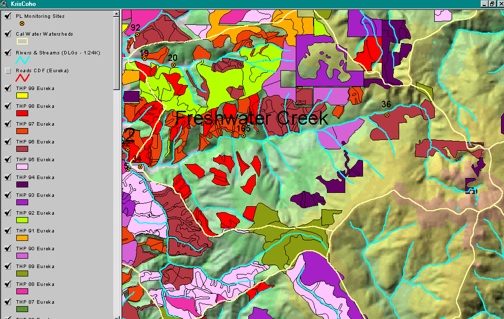
| Caption | Timber Harvest permits from California Department of Forestry by year for the upper Freashwater Creek watershed. Image from the Institute for Fisheries Resources KRIS Coho project. |
| CaptionTemplate | [Description] |
| Description | Timber Harvest permits from California Department of Forestry by year for the upper Freashwater Creek watershed. Image from the Institute for Fisheries Resources KRIS Coho project. |
| Filename | mfwthp99.gif |
| Filesize | 159372 |
| Meta_Id | insects |
| Notefile | humbay.htm#aqinsects |
| Path | topics/fc/mfwthp99.gif |
| Series | GIS: PALCO Aquatic Invertebrate, Sediment, Temperature Sampling Locations in late 1990s |
| SubBasin | Freshwater Creek-Ryan Slough |
| Basin | Humboldt Bay |
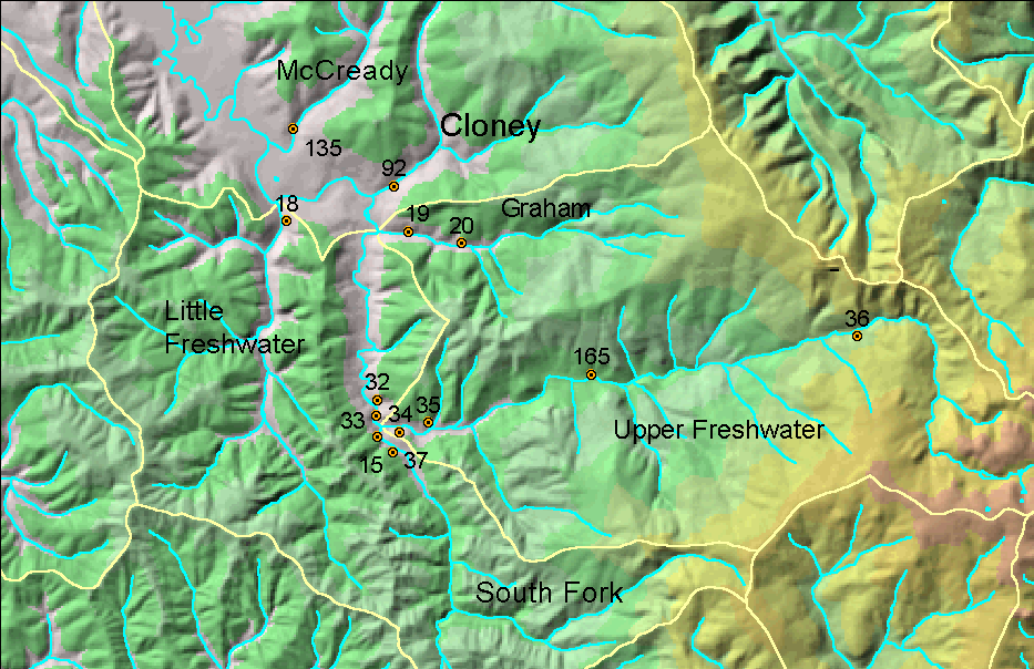
| Caption | This map shows the PL monitoring stations for Freshwater Creek and its tribtuaries, including where Hobotemps were deployed in 1998 and 1999. Map impage from Institute for Fisheries Resources. |
| CaptionTemplate | [Description] |
| Description | This map shows the PL monitoring stations for Freshwater Creek and its tribtuaries, including where Hobotemps were deployed in 1998 and 1999. Map impage from Institute for Fisheries Resources. |
| Filename | palcomon.gif |
| Filesize | 275773 |
| Meta_Id | fwtemp |
| Notefile | humbay.htm#temps |
| Path | topics/fc/palcomon.gif |
| Series | GIS: PALCO Aquatic Invertebrate, Sediment, Temperature Sampling Locations in late 1990s |
| SubBasin | Freshwater Creek-Ryan Slough |
| www.krisweb.com |