| Basin |
Humboldt Bay |
| Caption |
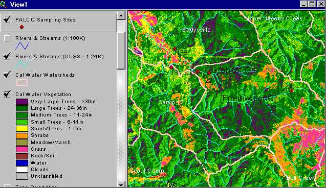
The vegetation image above is derived from a 1994 Landsat image which was classified by the Humboldt State University Spatial Analysis Lab (click on InfoLinks for more information about methods of classification). The large area of purple and deep green in the upper Freshwater Creek watershed represent large tracts of large second growth trees that are 60 to 100 years old. The orange and pink area at the top of Graham Gulch (above Stations 19 & 20) and along Little Freshwater Creek (above Station 18) are related to logging that took place just prior to 1994. Map by IFR. |
| CaptionTemplate |
[Description] |
| Description |
The vegetation image above is derived from a 1994 Landsat image which was classified by the Humboldt State University Spatial Analysis Lab (click on InfoLinks for more information about methods of classification). The large area of purple and deep green in the upper Freshwater Creek watershed represent large tracts of large second growth trees that are 60 to 100 years old. The orange and pink area at the top of Graham Gulch (above Stations 19 & 20) and along Little Freshwater Creek (above Station 18) are related to logging that took place just prior to 1994. Map by IFR. |
| Filename |
fcavplst.gif |
| Filesize |
49198 |
| Meta_Id |
VegType |
| Notefile |
humbay.htm#Seral |
| Path |
topics/fc/fcavplst.gif |
| Series |
GIS: Vegetation Types in Freshwater CW Watershed '94 |
| SubBasin |
Freshwater Creek-Ryan Slough |