| Caption |
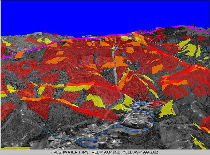
This three-dimensional GIS map shows timber harvest plans approved in the Freshwater Creek watershed from 1998-2002 draped over aerial photographs. Image downloaded from www.freshwater-kneeland.org. |
| CaptionTemplate |
[Description] |
| Category |
Geographic Information Systems - Maps |
| Description |
This three-dimensional GIS map shows timber harvest plans approved in the Freshwater Creek watershed from 1998-2002 draped over aerial photographs. Image downloaded from www.freshwater-kneeland.org. |
| Filename |
thp3d.jpg |
| Filesize |
70950 |
| Path |
fw_kneeland/thp3d.jpg |
| Restriction |
none |
| Series |
GIS: 3-D View of Freshwater Creek Timber Harvests 1988-2002 |
| UpdateDate |
2/7/2006 |
| UpdateName |
JEA |