Photo Pages. Photos on this page are from sub-basin Elk River
and series Erosion: Elk River Roads & Erosion 1996-97.
Click on any thumbnail to see a larger photo.
For detailed information on these photos click here.
279 KB
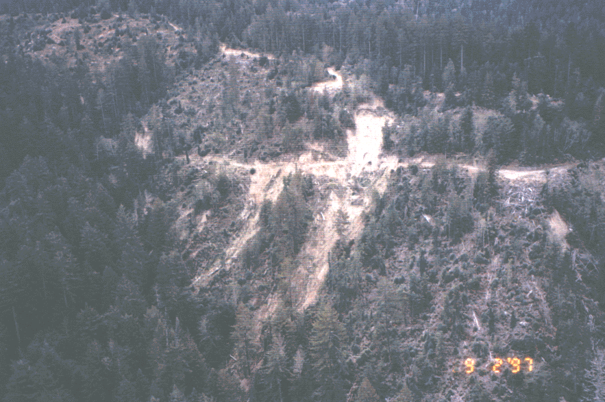
The photo above shows a debris torrent in the Elk River basin that initiated at a road. It is likely that this failure occurred during the January 1, 1997 storm event. Photo courtesy of the Humboldt Watershed Council.
198 KB
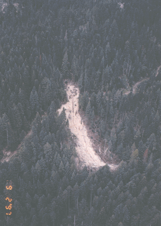
This debris slide in the Elk River basin appears to have been triggered by the road which crosses the photo. Photo courtesy of the Humboldt Watershed Council. September 1997.
246 KB
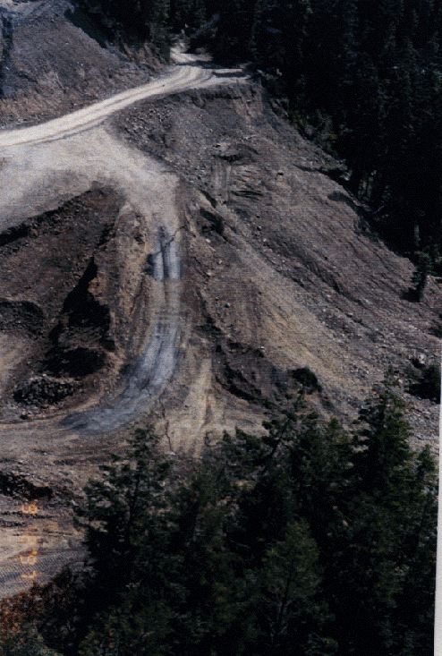
This road in the Elk River watershed has been reconstructed across an active landslide. Photo courtesy of the Humboldt Watershed Council. September 1997.
224 KB
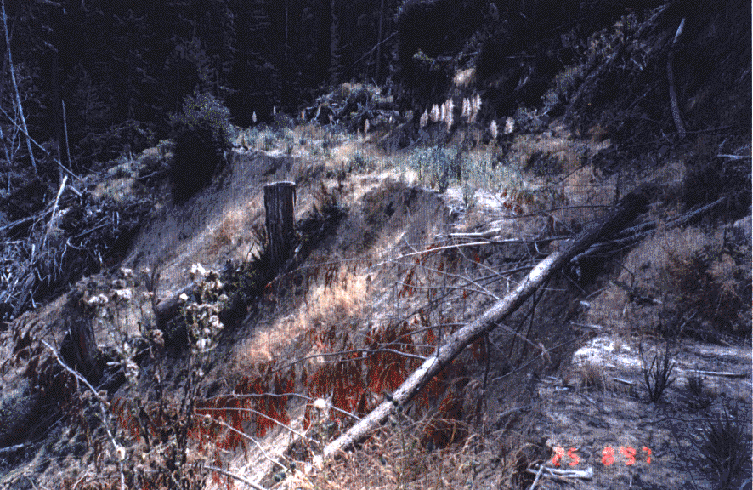
This photograph shows a landslide triggered by a logging road in the Elk River basin. Photo courtesy of the Humboldt Watershed Council. Note that post-logging vegetation is dominated by shrubs, grass and pampas grass.
308 KB
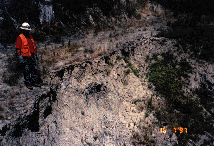
Failed road in the Elk River watershed in July 1997. Photo courtesy of the Humboldt Watershed Council.
327 KB
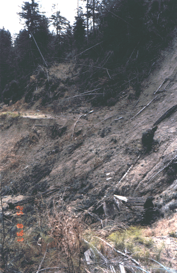
This photograph is of a road failure in the Elk River watershed. Landslides such as this can be triggered by fill slope or cut bank failures. August 1997. Photo courtesy of the Humboldt Watershed Council.
124 KB
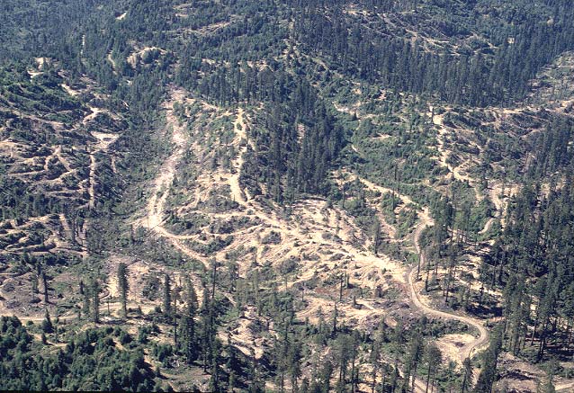
This photograph is of the upper North Fork Elk River watershed and shows logging roads as well as a dense network of tractor skid trails. Logging spur roads and tractor trails are not included in road density calculations. Photo courtesy of and copyright by Doug Thron Nature Photography.
 198 KB
 246 KB
 224 KB
 308 KB
 327 KB
 124 KB