Photo Pages. Photos on this page are from sub-basin Freshwater Creek-Ryan Slough
and series GIS: Vegetation Types in Eddysville CW Watershed '94.
Click on any thumbnail to see a larger photo.
For detailed information on these photos click here.
47 KB
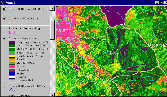
The vegetation image above is derived from a 1994 Landsat image which was classified by the Humboldt State University Spatial Analysis Lab (click on InfoLinks for more information about methods of classification). The continuous pink areas in the upper left (southwest) is pasture lands. Grass signatures in upland areas may be pampas grass (see Picture #2). Map by the Institute for Fisheries Resources.