Area/Topic  |  Bibliography   |  Background   |  Hypotheses   |  Home


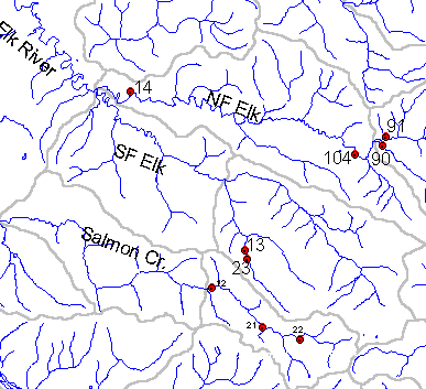
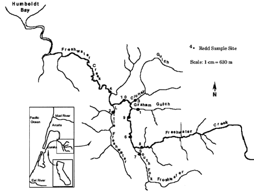
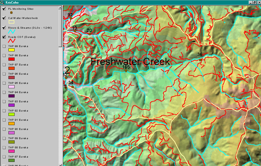
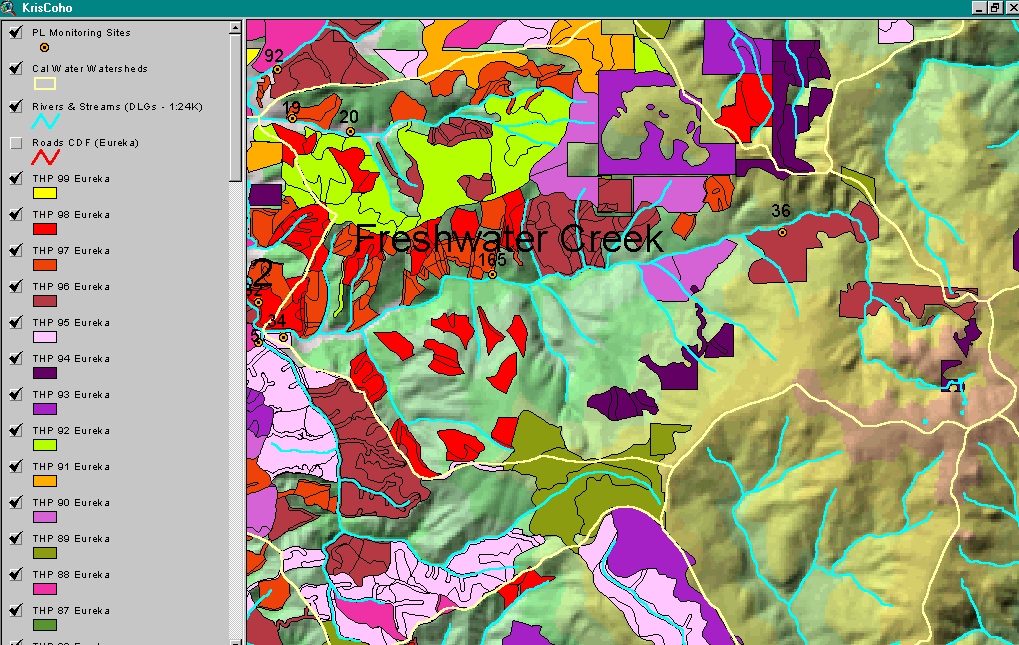
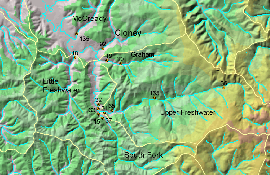
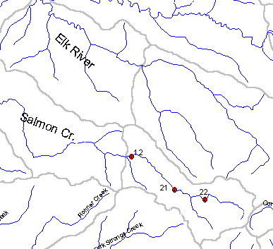
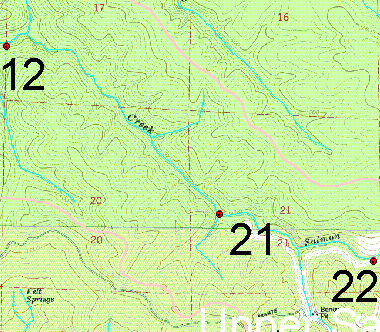
Photo Database Series GIS: PALCO Aquatic Invertebrate, Sediment, Temperature Sampling Locations in late 1990s

Click on any thumbnail to see a larger photo. For detailed information on these photos click here.

../topics/er/erplstat.gif + 10 KB   10 KB
Map from Institute for Fisheries Resources KRIS Coho map project and shows approximate location of PL Elk River sampling stations. Aquatic insect data is available from only stations 13,14 and 23.

../topics/fc/barnar.gif + 30 KB   30 KB
This map is from Barnard (1992) M.S. Thesis from Humboldt State University. Locations are very similar to those chosen by PL for monitoring and thus make an interesting pre-logging comparison for fine sediment versus PL shovel samples taken starting in 1994.

../topics/fc/mfwroads.gif + 209 KB   209 KB
Map image of main haul roads and county roads in the upper Freshwater Creek watershed with PL monitoring locations also displayed. Map from IFR KRIS Coho project.

../topics/fc/mfwthp99.gif + 159 KB   159 KB
Timber Harvest permits from California Department of Forestry by year for the upper Freashwater Creek watershed. Image from the Institute for Fisheries Resources KRIS Coho project.

../topics/fc/palcomon.gif + 275 KB   275 KB
This map shows the PL monitoring stations for Freshwater Creek and its tribtuaries, including where Hobotemps were deployed in 1998 and 1999. Map impage from Institute for Fisheries Resources.

../topics/sc/scplstat.gif + 7 KB   7 KB
This map image shows the relative locations of the Pacific Lumber Company aquatic insect and sediment monitoring stations within the Salmon Creek basin. Map from Institute for Fisheries Resources.

../topics/sc/sctopopl.gif + 32 KB   32 KB
This map shows the PL insect and fine sediment monitoring locations in the Salmon Creek watershed. Station number 12 is Lower Salmon, number 21 is Middle Salmon and 22 is Upper Salmon. Map from Institute for Fisheries Resources.


  www.krisweb.com