Photo Database Series GIS: Vegetation Types in Landsat for Upper Salmon Cr Cal-Watershed 1994
Click on any thumbnail to see a larger photo.
For detailed information on these photos click here.
36 KB
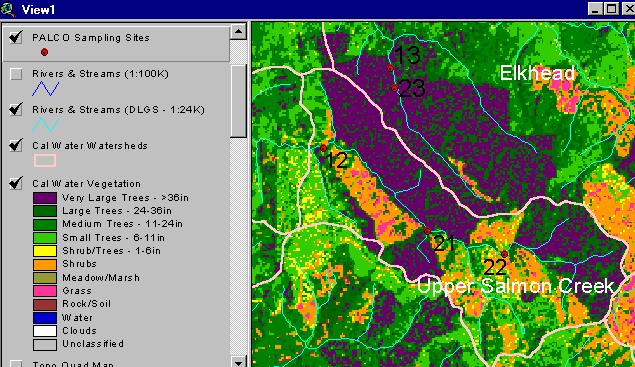
The vegetation image above is derived from a 1994 Landsat image which was classified by the Humboldt State University Spatial Analysis Lab (Click on InfoLinks for more on method of classification). The dark purple at the top (north) of the watershed is the old growth of Headwaters Forest. The high shrub and shrub/tree component (orange and yellow) indicate recent watershed disturbance related to logging (see Picture 3). Use the Zoom and Pan functions to see the map in more detail (see Help System).