| Area |
Arcata |
| Topic |
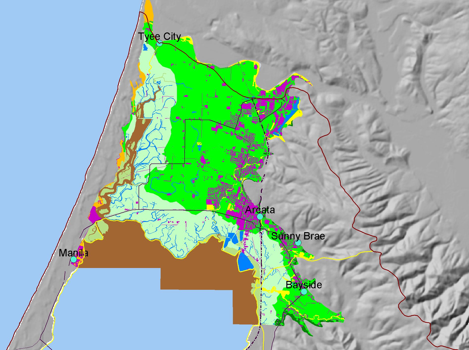
Map: Q. Landuse Arcata Bottoms 2000, Arcata Sub-basin |
|
This is a map of landuse in the Arcata Bottoms, circa 2000, based on digitized historic maps. Although the majority of land use is agricultural and diked bayland, a much
greater proportion is classified as developed than in 1941.
|
|
|
 |
 |
To view metadata about a map layer, click on a link in the table below.
| Name of Layer in Map Legend | Metadata File Name |
|---|
| Project Outline | Unavailable |
| Sub Basins | subbasins.shp.txt |
| Towns | Unavailable |
| Roads (1:100k) - Abbreviated | Unavailable |
| Landuse Arcata Bottoms 2000 | landuse00_u27.shp.txt |
| Gray Hillshade (30 meter Resolution) [TIFF] | grayshade30m.tif.txt |
| Pacific Ocean | Unavailable |
If you obtain KRIS on a CD and install it on your hard drive as a desktop program, you will have access to increased map capabilities such as zooming in/out, turning layers on/off, adding layers and changing legends.
