| Area |
Basin-wide/Regional |
| Topic |
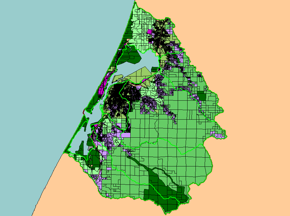
Map: K. Parcels by Zoning, Humboldt Bay |
To view a more detailed version of this map click
here
|
This map shows parcels classified by zoning category in the Humboldt Bay Basin. Open space and parks are presumably public lands, while agricultural, residential,
commercial, industrial, and timber production are private lands.
|
|
|
 |
 |
To view metadata about a map layer, click on a link in the table below.
If you obtain KRIS on a CD and install it on your hard drive as a desktop program, you will have access to increased map capabilities such as zooming in/out, turning layers on/off, adding layers and changing legends.
