| Area |
Basin-wide/Regional |
| Topic |
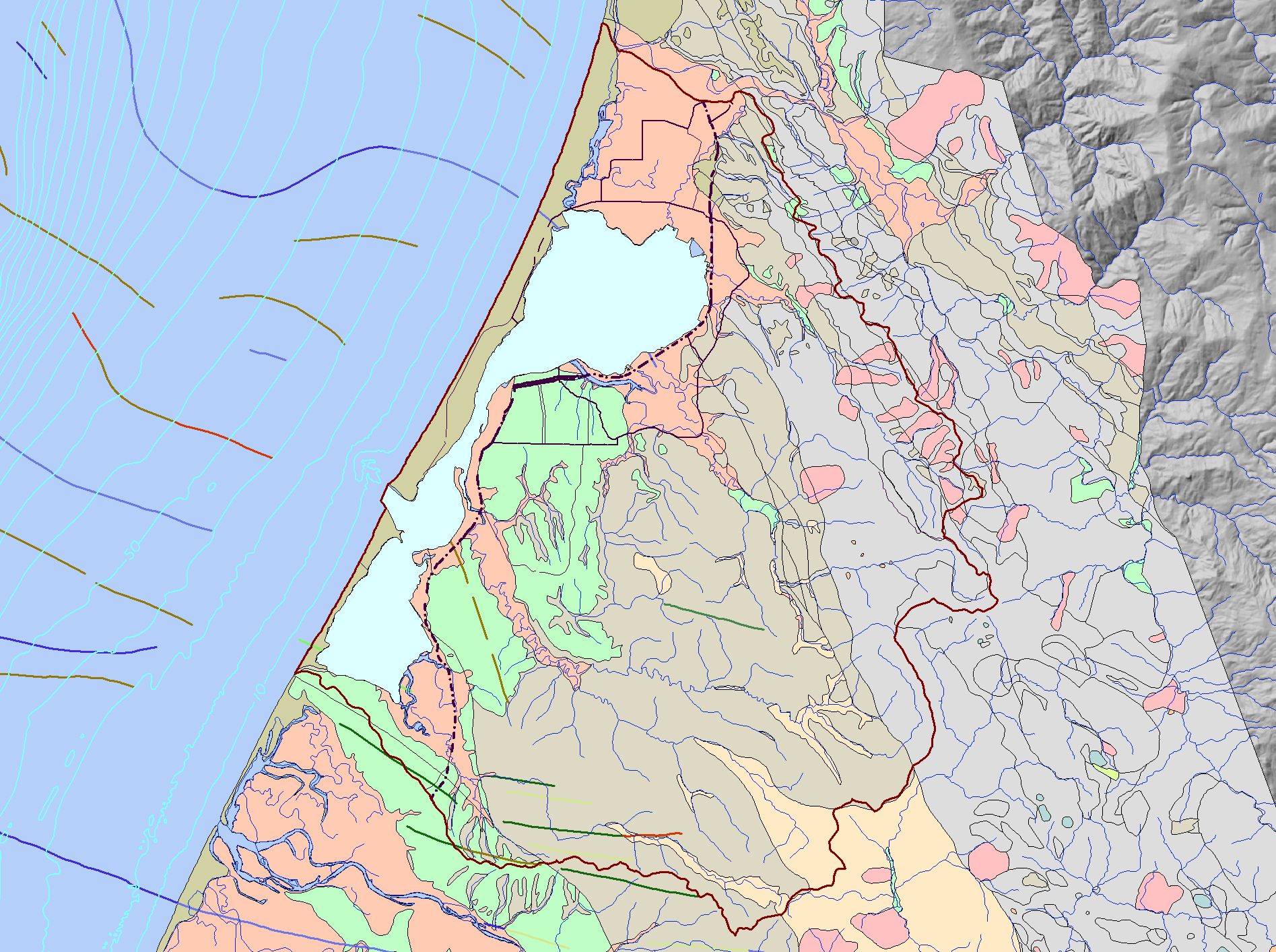
Map: L Geology, Humboldt Bay |
|
This is a map of geology in the Humboldt Bay Basin. Data include geomorphology, and strikes and dips, and bathymetry.
|
|
|
 |
 |
To view metadata about a map layer, click on a link in the table below.
| Name of Layer in Map Legend | Metadata File Name |
|---|
| Project Outline | Unavailable |
| Humboldt Bay | Unavailable |
| Roads (1:100k) - Abbreviated | Unavailable |
| Streams (1:100k) | stm100.shp.txt |
| Bathymetry [USGS 2000] | Unavailable |
| Strike and Dip Geology (USGS) | humbay_str.shp.txt |
| Geology (USGS 2000) | humbay_geol.shp.txt |
| Gray Hillshade (30 meter Resolution) [TIFF] | grayshade30m.tif.txt |
If you obtain KRIS on a CD and install it on your hard drive as a desktop program, you will have access to increased map capabilities such as zooming in/out, turning layers on/off, adding layers and changing legends.
