| Area |
Basin-wide/Regional |
| Topic |
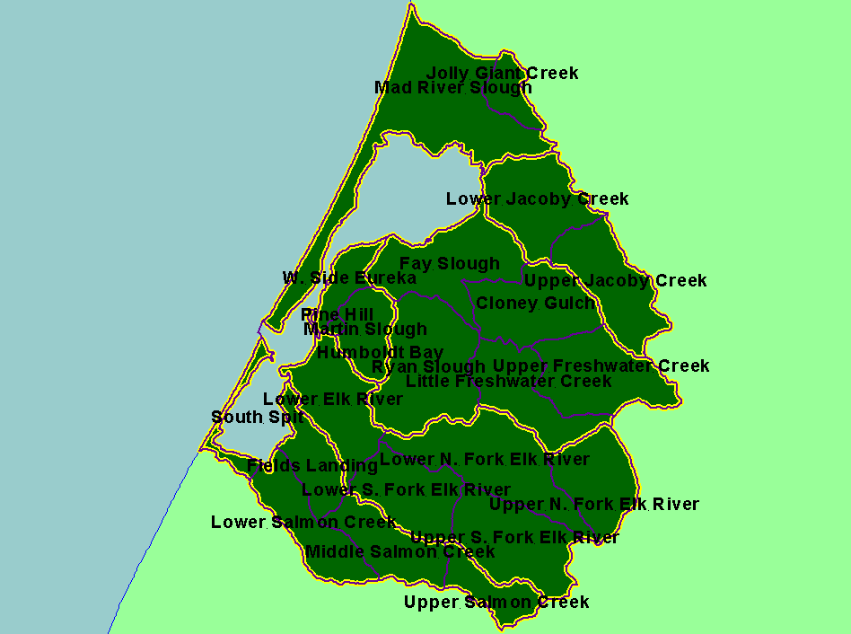
Map: C. Calwater Planning Watersheds, Humboldt Bay |
To view a more detailed version of this map click
here
|
This is a map of the 23 Calwater Planning Watersheds within the Humboldt Bay Basin. Scale = 1:246,877 .
|
|
|
 |
 |
To view metadata about a map layer, click on a link in the table below.
| Name of Layer in Map Legend | Metadata File Name |
|---|
| Calwater Planning Watersheds w/labels (CDF) | calw22.shp.txt |
| Sub-basins | subbasins.shp.txt |
| State of California | Unavailable |
| Pacific Ocean | Unavailable |
If you obtain KRIS on a CD and install it on your hard drive as a desktop program, you will have access to increased map capabilities such as zooming in/out, turning layers on/off, adding layers and changing legends.
