| Area |
Eureka |
| Topic |
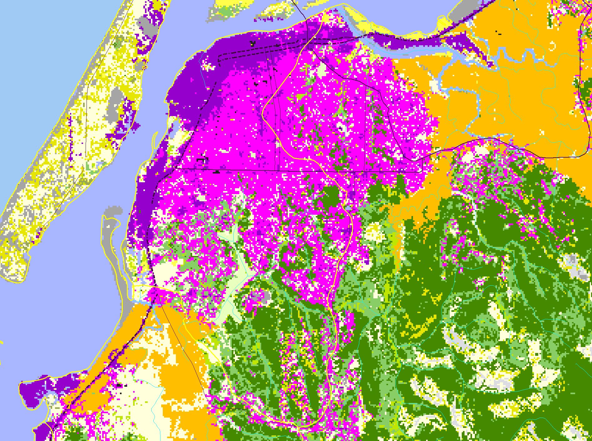
Map: D. EPA Landcover/Landuse, Eureka Sub-basin |
|
This is a map of the EPA Landcover/Landuse in the Eureka sub-basin, based on a 1992 Landsat TM satellite image. The sub-basin is mostly residential-commercial.
Coniferous forest (green) and mixed forest (lighter green) are visible to the south, although shrubs and grassland are now evident in timber harvested areas that were
once totally coniferous forest. Herbaceous patches and residential-commercial classes are indicative of deforestation and urban encroachment.
|
|
|
 |
 |
To view metadata about a map layer, click on a link in the table below.
If you obtain KRIS on a CD and install it on your hard drive as a desktop program, you will have access to increased map capabilities such as zooming in/out, turning layers on/off, adding layers and changing legends.
