| Area |
Jacoby Creek |
| Topic |
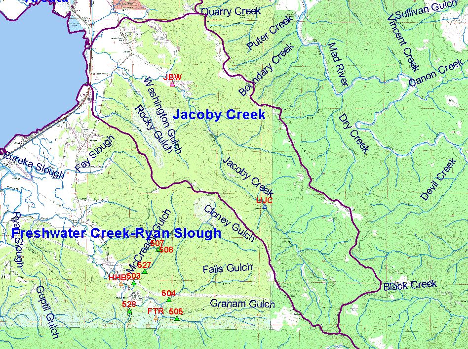
Map: M. Turbidity Threshold Sampling Stations, Jacoby Creek Sub-basin |
|
This map show the location of turbidity threshold sampling stations in the Jacoby Creek sub-basin. Data collectors include Salmon Forever, PALCO, Redwood
Sciences Lab, and Randy Klein.
|
|
|
 |
 |
To view metadata about a map layer, click on a link in the table below.
| Name of Layer in Map Legend | Metadata File Name |
|---|
| Turbidity Threshold Sampling Stations (labels) | Unavailable |
| Turbidity Threshold Sampling Stations | Unavailable |
| Sub Basins | subbasins.shp.txt |
| Sub Basins with Labels | subbasins.shp.txt |
| Streams w/ labels (1:24k) | stm24.shp.txt |
| Pacific Ocean | Unavailable |
| TOPO MAP | Unavailable |
If you obtain KRIS on a CD and install it on your hard drive as a desktop program, you will have access to increased map capabilities such as zooming in/out, turning layers on/off, adding layers and changing legends.
