| Area |
Jacoby Creek |
| Topic |
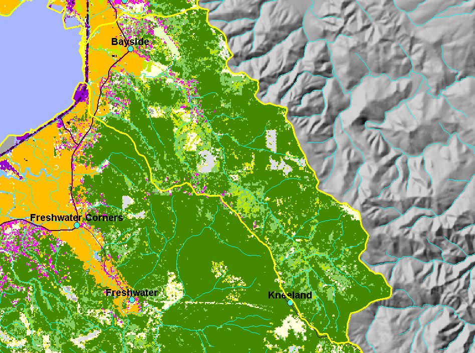
Map: D. EPA Landcover/Landuse, Jacoby Creek Sub-basin |
To view a more detailed version of this map click
here
|
This is a map of the EPA Landcover/Landuse in the Jacoby Creek sub-basin, based on a 1992 Landsat TM satellite image. Flat areas in the northern portion are
mostly agriculture (orange). Patches of coniferous forest (green) and mixed forest (lighter green) dominate the slopes east of the bay.
|
|
|
 |
 |
To view metadata about a map layer, click on a link in the table below.
If you obtain KRIS on a CD and install it on your hard drive as a desktop program, you will have access to increased map capabilities such as zooming in/out, turning layers on/off, adding layers and changing legends.
